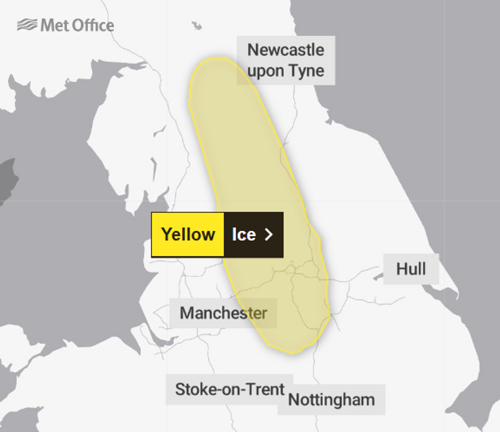
The Met Office has issued a yellow ice warning amid fears of “accidents and injuries”.
The East Midlands, North East England, North West England and Yorkshire and Humber are set to be affected between 3-9am Thursday morning.
The forecaster has predicted wintery showers and temperatures close to freezing which could lead to icy surfaces.
The Met Office said: “Showers will continue at times through Wednesday and Wednesday night, these falling as sleet or hail at times, and perhaps temporarily as snow over hills.”
The forecaster has predicted wintery showers and temperatures close to freezing which could lead to icy surfaces
MET OFFICE
“Clear spells in between will allow temperatures to fall close to zero, with some untreated surfaces turning icy later tonight and at first on Thursday, especially over the Pennines and Peak District.”
They have released advice, urging pedestrians to use pavements that are less slippery and cyclists to stick to main roads which have been treated.
The Met has also urged people to leave the house earlier than usual.
“Not needing to rush, reduces your risk of accidents, slips, and falls,” the advice reads.
MORE LIKE THIS:
- UK weather forecast: Frost and ice RETURN with temperatures ‘plummeting’ as bitter conditions strike Britain
- UK weather: Temperatures surge towards 20C as Britain ‘hotter than Ibiza’ ahead of ‘Polar Vortex’ warning
- UK weather: ‘Icelandic ice dome’ to trigger ‘early spring chill’ as temperatures set to plummet
This comes after the country experienced warm and sunny weather over the weekend, with temperatures exceeding those of Madrid, Spain on Saturday.
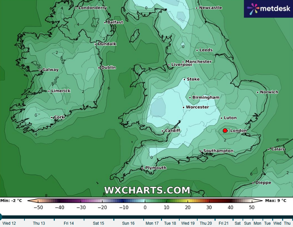
However, the UK is now in the grips of a cold snap with frost, wintry showers and plummeting temperatures set to affect much of the country.
Discussing mercury’s fall over the coming days, Met Office meteorologist Tom Morgan said: “Despite the temperature on the thermometer reading seven, eight or nine degrees, it is below average for this time of year. When you factor in the wind chill which will be fairly brisk on the northern and eastern coast in particular it will feel more like three to five degrees.”
He added: “Temperatures may fall as low as -4C or -5C across parts of Scotland and Northern Ireland.”
The UK is now in the grips of a cold snap with frost, wintry showers
WXCHARTS
Thursday will bring another chilly day with sunshine and showers across the UK. The showers will be most widespread across central, eastern and far northern parts of the country.
Some western areas are expected to remain largely dry throughout the day.
Looking ahead to Friday, the pattern of sunshine and showers will continue. Some of these showers could be wintry, particularly on higher ground.
The weekend brings more promising conditions with fewer showers forecast. A lot of fine weather is expected on Saturday and Sunday.