A triple-vortex winter storm loaded with torrents of snow will leave swaths of America petrified in a crippling ice glaze.
Freezing misery is about to roar back as experts warn ‘a myriad of impactful weather’ threatens travel chaos, dangerous temperatures and power outages.
A pair of storms followed by a third next week will smash into an ‘Arctic anticyclone’ of cold air unleashing a deadly ice storm.
The deadly events cause thick coats of ice to rapidly form on trees and powerlines, and over roads and pavements.
Freezing misery is about to roar back as experts warn ‘a myriad of impactful weather’ threatens travel chaos, dangerous temperatures and power outages
Getty
AccuWeather meteorologist Brandon Buckingham said: “A clash of warm, humid air and cold Arctic air will result in a myriad of impactful weather for millions of Americans this week.
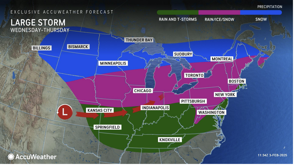
“A dangerous ice storm and accumulating snow are expected between Wednesday and Thursday as a storm races east.
“The ingredients for a major ice storm are expected to be in place from the Midwest to the Great Lakes, and the potential exists for dangerous amounts of ice build-up into Thursday, and this poses a risk for tree damage and power outages as the storm moves through.”
The second storm will plough through the US later this week bringing more snow and freezing temperatures.
Temperatures across eastern and south-eastern states will nosedive around 10F from the start of the week.
Around half an inch of ice glazing roads and pavements will make travel in parts “impossible”, experts warn.
LATEST DEVELOPMENTS:
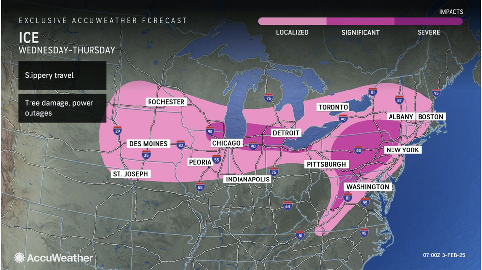
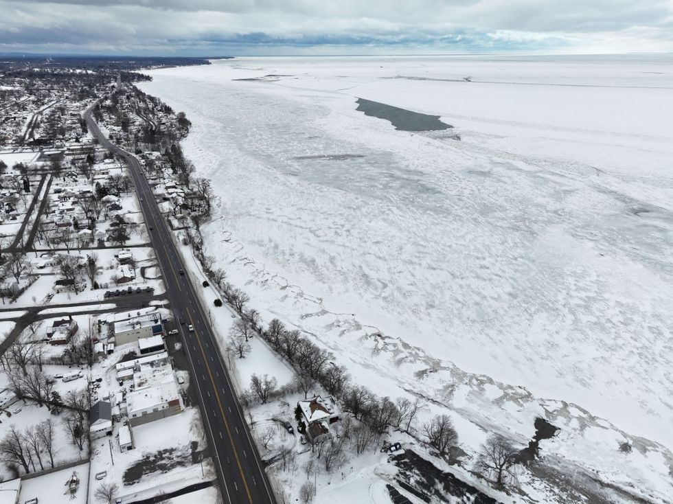
Around half an inch of ice glazing roads and pavements will make travel in parts “impossible”, experts warn
AccuWeather
AccuWeather meteorologist Jonathan Porter said: “Ice storms are incredibly dangerous.
“A light glaze of ice can create treacherous driving conditions on bridges, highways and ramps in a matter of seconds, while travel on the roads could be virtually impossible at times in the hardest-hit areas.”
AccuWeather’s Paul Pastelok added: “A second winter storm will follow this midweek storm, with snow and ice impacting some of the same areas starting Friday through the weekend.
“A third storm is possible early next week, with the potential of colder air and more moisture that could bring snow and icy impacts to a larger area.”
Cold weather will be driven by a huge high-pressure system sinking south from the Arctic.
Warnings are in force across swaths of America for winter storms and snow
AccuWeather
The US National Weather Service (NOAA) has warnings in force across swaths of America for winter storms and snow.
A spokesman said: “The story will be Arctic high pressure nosing southward across the northern Plains and Midwest.
“This cold air will be in place though ahead of a new storm system approaching the Ohio Valley and Mid-Atlantic region by Wednesday night and Thursday which is expected to drive a concern for some light snowfall, but also a swath of sleet and freezing rain.”
Jim Dale, US meteorologist for British Weather Services and co-author of ‘Surviving Extreme Weather’, said: “Cold air over the Great Lakes is still going to be an issue with milder air to the south and the risk of snow where the two meet.
“While warmer weather is forecast to the southwest of the country, there is a risk of further wintry weather to the east, especially with Lake-Effect snow.”