A massive storm duo spanning 12 states will unleash a “hazardous mix” of wind, rain, blizzards and crippling freezing rain.
Holiday travel hell looms as a nightmare before Christmas weather disaster puts the United States on standby for power cuts, floods and feet of snow.
National winter weather warnings are in force across hundreds of miles of northern America, with separate winter-storm alerts covering Montana, Idaho and Wyoming.
Stormy weather will be driven by a “train” of cyclonic low-pressure systems charging eastwards through the run up to Christmas.

A massive storm duo spanning 12 states will unleash a “hazardous mix” of wind, rain, blizzards and crippling freezing rain
Accuweather
AccuWeather meteorologist Tom Kines said: “A pair of storms hitting the West Coast could bring up to eight inches of flooding rainfall to parts of Northern California, with feet of snow expected in the Sierra.
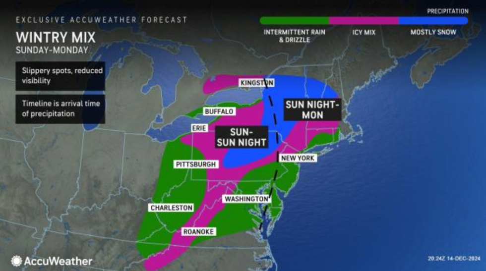
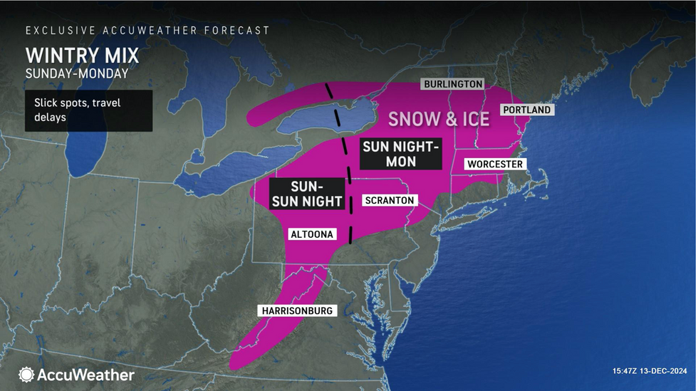
“A mix of snow, ice and rain is forecast across nearly a dozen states from Nebraska to Michigan as the storm moves from the Plains to the Midwest, while another storm could bring a slippery wintry mix to parts of the Midwest, Great Lakes and into the interior Northeast.”
North-eastern states are in the firing line at the start of the week, with “dangerous” freezing rain threatening travel hell.
Unlike snow, supercooled rain falls in liquid form before hitting the ground where it instantly freezes into deadly sheets of ice.
Winter storms that unload large volumes of rain as air temperatures plunge can trigger treacherous conditions on the roads.
Kines said: “It doesn’t take much ice or freezing rain to cause serious problems, and travel can quickly turn dangerous with a storm like this.
LATEST DEVELOPMENTS:
“Both storms will lead to locally heavy rain stretching from California north to Washington, with mountain snow in the Cascade and Sierra Nevada ranges.
“Along with gusty winds at the coast and in the higher elevations, the storms can impact travel up and down the coast and at major airports.”
A “conveyor belt of storms” is lined up to drive through the United States through the week and into the festive run-up.
Wind and rain from the Pacific will smash into the west coast, hitting colder air sweeping down from Canada.
The biggest of a succession of storms is expected to hit mid-week, with heavy rain turning to snow over the Great Lakes.
Jim Dale, US meteorologist for British Weather Services and co-author of ‘Surviving Extreme Weather’, said: “Wednesday is going to be the day when this storm gets a hold, and this could reach as far south as Kansas, Arkansas, and Tennessee, as a cold front moves in through the end of the week.

Stormy weather will be driven by a “train” of cyclonic low-pressure systems charging eastwards through the run up to Christmas
Accuweather
“Another low then comes in on Friday, but this one is smaller and is not expected to cause as much disruption.
“There will be a risk of snow over the Great Lakes as cold air moves over the east of the country.”
Disruptive weather will reach as far north as New England and New York as Lake-effect snow spreads to the Atlantic coast.
“There is a mix of all sorts going on this week,” Dale said.
“And there is the risk of snow and stormy conditions in the run-up to Christmas, with snow likely on Christmas Day, the uncertainty is exactly where that is going to hit.”