Train services remain disrupted following Storm Darragh with several lines closed due to fallen trees and debris, as the clean-up operation gets under way.
The fourth named storm of the season brought strong gusts to many parts of the country over the weekend, with millions warned to stay indoors.
Winds will gradually ease with noticeably less rainfall by Wednesday but temperatures will stay in the single figures, the Met Office has said.
Passengers were warned to expect cancellations and delays to train services on the West Coast Main Line between London Euston and Scotland early on Monday.
Great Western Railway said passengers should “not attempt to travel” between Swansea and Carmarthen until at least noon, or on the Looe, St Ives and Gunnislake branch lines in Cornwall until at least 11am on Monday.
Transport for Wales said all railway lines were blocked on 11 routes, such as between Swansea and Milford Haven, between Swansea and Shrewsbury, between Birmingham International and Shrewsbury, and between Chester and Holyhead.
Chris Baughan, Network Rail’s West Coast South route operations manager, said: “Storm Darragh has wreaked havoc on the railway this weekend and we are very sorry to passengers for the disruption to train services this morning on the West Coast Main Line as frontline teams continue with emergency repairs and the clean-up.
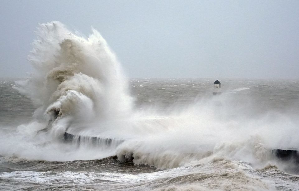
Waves crash against the lighthouse in Seaham Harbour, County Durham (Owen Humphreys/PA)
Two men were killed by falling trees hitting their vehicles on Saturday, while the Energy Networks Association said around 118,000 customers were still without power on Sunday evening.
The highest wind gusts were 96mph, recorded at Berry Head in Devon on Saturday.
Met Office meteorologist Liam Eslick said: “Storm Darragh has now moved its way off towards the south east, so things are going to start to settle down over the next couple of days.
“But it is still going to remain quite blustery, especially for south and south east of England, for the next day at least.”
Cloud towards the South East will bring the chance of localised, potentially heavy showers but these should move through quickly, Mr Eslick said.
The highest wind gusts were 96mph, recorded at Berry Head in Devon on Saturday (Jacob King/PA)
Much of the rest of the country further north will see calmer winds and plenty of sunshine due to an area of high pressure moving in, but will feel chilly with highs in the mid to low single figures.
Any remaining winds will die down by Tuesday, with the exception of areas around the English Channel and southern coast.
There will again be longer sunny spells developing in northern parts of the country while cloud will settle across Wales and southern England, but temperatures will widely remain low.
Some widespread fog will develop under clear skies in the north overnight into Wednesday morning and could be slow to clear.

