A massive storm will drive a plume of hot air across America while dragging freezing and winds and snow in its wake.
The US is about to be split in two with central and eastern states gearing up for unseasonal warmth while the west braces for a whiteout.
Churning hot and cold air astride a huge low-pressure cyclone will create a battle zone of gales, snow and torrential rain.
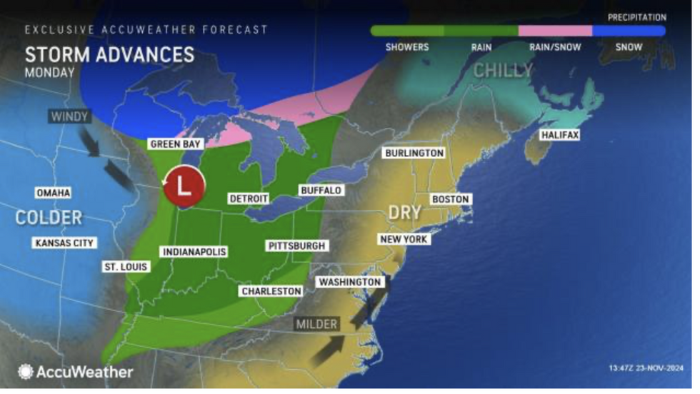
AccuWeather meteorologist Emma Belshcher said: “An area of low pressure is expected to move north-eastward toward Michigan, and as it does, warm air will surge into the Lower Peninsula of Michigan pushing thermometers into the 40Fs and lower 50Fs.

Snow is expected in northern Minnesota, northern Wisconsin and the remainder of the Upper Peninsula of Michigan
AccuWeather
“Temperatures across much of the Midwest will feels more like the start of November rather than the end of the month, during the start of the week.
“To the northwest of the low track, colder air will pour southward, and this will cause the rain to mix with snow from central Wisconsin to the eastern Upper Peninsula of Michigan.
“Even farther to the northwest, snow is expected in northern Minnesota, northern Wisconsin and the remainder of the Upper Peninsula of Michigan.”
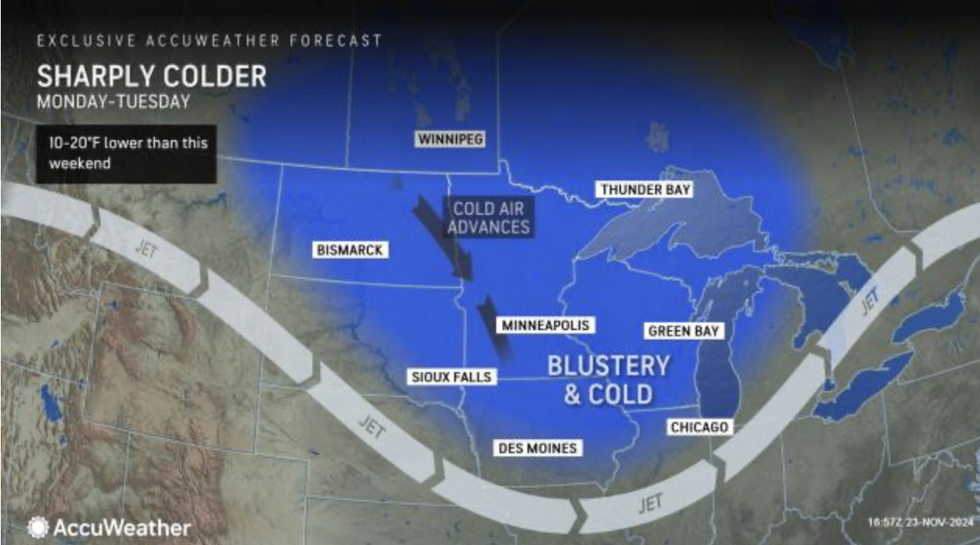
While parts of the country enjoy temperatures more typical of early autumn, elsewhere will feel like mid-December.
Up to two inches of snow could settle to low ground, experts warn, with higher totals expected over the hills.
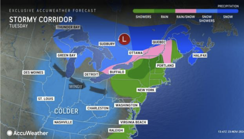
The storm will strengthen on its path across the states whipping up gales and heavier snow over the Great Lakes.
AccuWeather meteorologist Ryan Adamson said: “With the wind coming from a north-westerly direction, colder air will arrive in all but the eastern Great Lakes and as far south as the Ohio Valley and Tennessee Valley.
LATEST DEVELOPMENTS:

Where showers collide with cold air behind the Midwest storm, heavy snow will cascade
AccuWeather
“Wind flow over the ice-free lakes will promote lake-effect snow showers in northern Wisconsin, throughout the Upper Peninsula of Michigan and north-western Lower Michigan.”
Western and north-western regions reeling from heavy downpours unleashed by an ‘atmospheric river’ of rain before the weekend threatens further misery.
Where showers collide with cold air behind the Midwest storm, heavy snow will cascade.
Weather Channel meteorologist Danielle Banks said: “A potent atmospheric river of moisture has already soaked northern California, and more moisture will spread into the west as storm systems move across the Pacific.
“The ‘bomb cyclone’ that kicked-off this stormy pattern last Tuesday became one of the strongest storms on record.
“Into the week, there will be periods of rain and mountain snow, and once again there will be several concerns including flooding, debris flow and power outages.”

The storm will strengthen on its path across the states whipping up gales and heavier snow over the Great Lakes
AccuWeather
Up to four feet of snow could fall through the start of the week, she warned, with higher levels seeing up to five feet.
The US National Weather Service (NOAA) has winter storm alerts in force across California and Montana, and numerous more widespread snow and ice alerts.
Northwest coasts are also braced for strong winds as storms plough in from the Pacific.
A NOAA spokesperson said: “Temperatures will drop sharply from highs in the 60Fs and 70Fs to the 40Fs and 50Fs at the start of the week.
“The associated warm front will spread mild air across the Eastern United States on Monday before a cold front arrives and drops temperatures for the rest of the week.”
Jim Dale, US meteorologist for British Weather Services and co-author of ‘Surviving Extreme Weather’, said: “In parts of the country we are going to see quite a sharp transition from autumn into winter with heavy snow on the way.”