Bitter polar winds will plough into warm air left from summer to unleash a deluge of thunderstorms.
A sharp change in the weather awaits the US as the jet stream surges southwards across western states.
On the other side of the country, a northwards loop of the jet will keep temperatures above 60F.
Where the two air masses collide, fireworks will erupt triggering torrential rain and the threat of ‘severe’ storms.
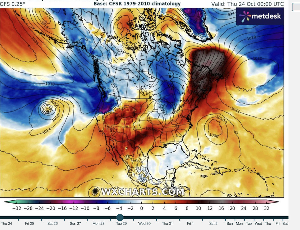 Cold air collides with warm air to the south (WX charts)Cold air collides with warm air to the south (WX charts)
Weather Channel meteorologist Johnathan Erdman said: “There are some changes coming later this week.
“Models are forecasting a southwards plunge of the jet stream into the west, and that will bring cold air from the northwest into the Rockies and eventually into parts of the Plain states.
“At the same time, an upper-level ridge of high pressure works its way into the Midwest and parts of the east, and that will bring warmer air into parts of the Ohio valley and eventually into parts of the east.
“Where cold air trough meets the warmer air ahead of it, we expect thunderstorms to break out and this could bring some locally heavy rain and even some severe weather to parts of the central US.”
US LATEST:
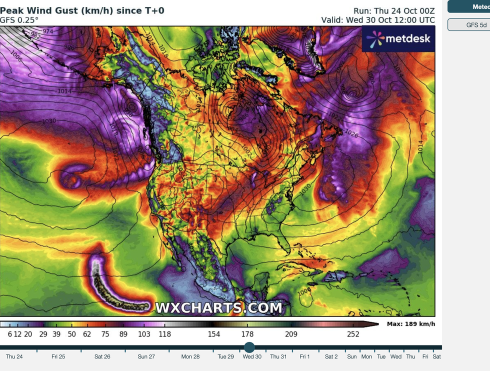
Wind gusts where masses meet
WX charts
Tropical storms so far
The Weather Channel
It comes after a calm start to the week brought a welcome relief after the recent spate of volatile weather.
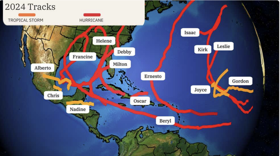
Florida is reeling from a double-whammy assault from Hurricane Helene at the start of the month and then Hurricane Milton.
The cost of the two storms will run into hundreds of billions of dollars in one of the biggest hurricane clean-ups on record.
The next two weeks will bring another shake-up in the weather as cold air from the north battles warmth left over from the summer heatwave.
Erdman said: “The forecast set up for next week shows some additional changes coming.
“Expect two cold fronts to swing through – one from the Great Lakes and Midwest into the northeast Wednesday into Thursday, and then we expect another cold front to arrive later this week in the Great Lakes and this weekend into the northeast.
“By the weekend, we expect most of the Great Lakes and the northeast to have high temperatures lower than 60F.”
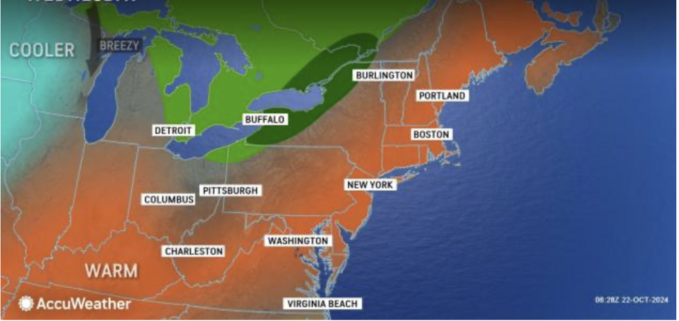
Cooler air moves into warm air
Accuweather
Despite the post-hurricane calm, south-eastern states will remain in the firing line for further tropical activity.
Hurricane Oscar whipped up at the weekend but stayed away from the US to bring stormy conditions to the Caribbean.
Tropical storm Nadine followed a similar path, bubbling up in the warm waters of the Gulf of Mexico before fizzling without incident.
However, the hurricane threat is far from over with warnings the next could arrive with little warning.
Jim Dale, US meteorologist for British Weather Services and co-author of ‘Surviving Extreme Weather’, said: “Florida and Louisiana are still getting stuff off the Gulf of Mexico, and there is still the risk of something more unsettled pushing through.
“There is still a lot of energy in the Gulf that will fuel these storms.”