‘Bone-dry’ winds and a rainless start to autumn have turned parts of the US into a tinderbox on alert for deadly wildfires.
Swaths of America left ‘abnormally dry’ after near-record summer heat are now at flash point.
Leaf-fall over the coming weeks will worsen the threat amid forecasts in parts of more warm, dry weather.
A large region of high pressure, which drives calm, rainless skies, will keep much-needed rain at bay, experts warn.
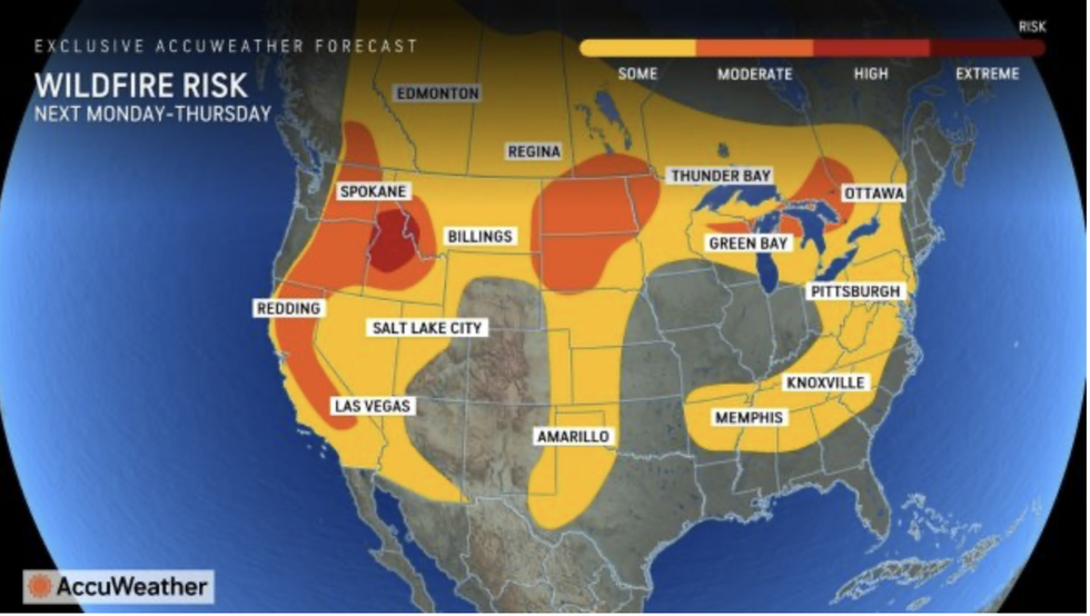 America left ‘abnormally’ arid as ‘bone-dry’ winds threaten to spark deadly wildfiresAccuWeather
AccuWeather meteorologist Paul Pastelok said: “A strong area of high pressure will bring continued dry conditions to a large portion of the East.
“Areas that have been dry will face an increased risk of brush fires and wildfires, especially the mid-Atlantic, parts of the Tennessee Valley, and parts of the Southeast inland from the Gulf of Mexico.
“It could be weeks before drenching downpours arrive, and the abnormally dry and, in some places, drought conditions are raising the risk of wildfires.”
The northeast and mid-Atlantic are reaching peak wildfire season driven by dry winds and autumn leaf-fall.
US LATEST:
An unusually dry start to the season in New York, Philadelphia, Pennsylvania and New Jersey has plunged the region into drought.
AccuWeather spokesman Dan DePodwin said: “It has been weeks since enough rain fell to measure in New York, Philadelphia and Allentown, Pennsylvania, and Atlantic City, New Jersey.
“Abnormally dry to drought conditions have expanded considerably in the last month.
“Autumn can be one of the most active times of year for wildfires in the Northeast and mid-Atlantic, and without tropical systems, dry stretches are common and gusty winds become more common.”
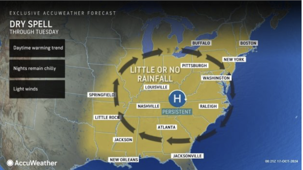
Dry spell over east of US
AccuWeather
Temperatures through the coming days are forecast to push into the 80Fs before an overnight plunge.
High pressure leading to clear skies will bring drops of 50F in parts of the country with the added risk of frosts.
Pastelok said: “Temperatures will drop into the 40s and 50s in the mid-Atlantic and can sneak into the frosty 30Fs over the interior.”
A hangover from the long summer heatwave will inflame the wildfire risk, with miles of ground still parched.
Dry winds with little rain will fan any fires that ignite, quickly spreading them across affected regions.
Jim Dale, US meteorologist for British Weather Services and co-author of ‘Surviving Extreme Weather’, said: “It is dry as a bone in parts of the country, and with very dry winds there will be a risk of fires spreading.
“This is a knock-on from the summer heatwave, in part, and because of high pressure and very dry conditions.
“The high may eventually shift, but even then there is not much in the way of showers where they are needed.”
Meanwhile, the first snow of the season has hit western States, smothering Nevada and Colorado under a winter blanket.
A spokesman for The Weather Channel said: “The first flakes of the season have begun dusting parts of western US.
“In Sierra, Nevada, widespread flurries have painted the landscape white.
“Though the highest peaks saw some snow weeks ago, for many, this was the first true taste of the season.”