Britons have been told to brace for an impending “weather bomb” as 80mph winds are set to whip parts of the country.
Forecasters at the Met Office have already issued three days of yellow wind warnings across Scotland and Northern Ireland on Friday, Sunday and Monday – with the latter warning extending to parts of England and Wales, too.
Tomorrow, residents of the Scottish islands, including Harris and Skye, are advised to hunker down as “strong winds and high spring tides” threaten public transport, coastal roads and some power from 7am to 3pm.
Then, from 3am on Sunday to midday on Monday, the winds will surge further in all directions, buffetting areas from Bangor to the Shetland Islands.
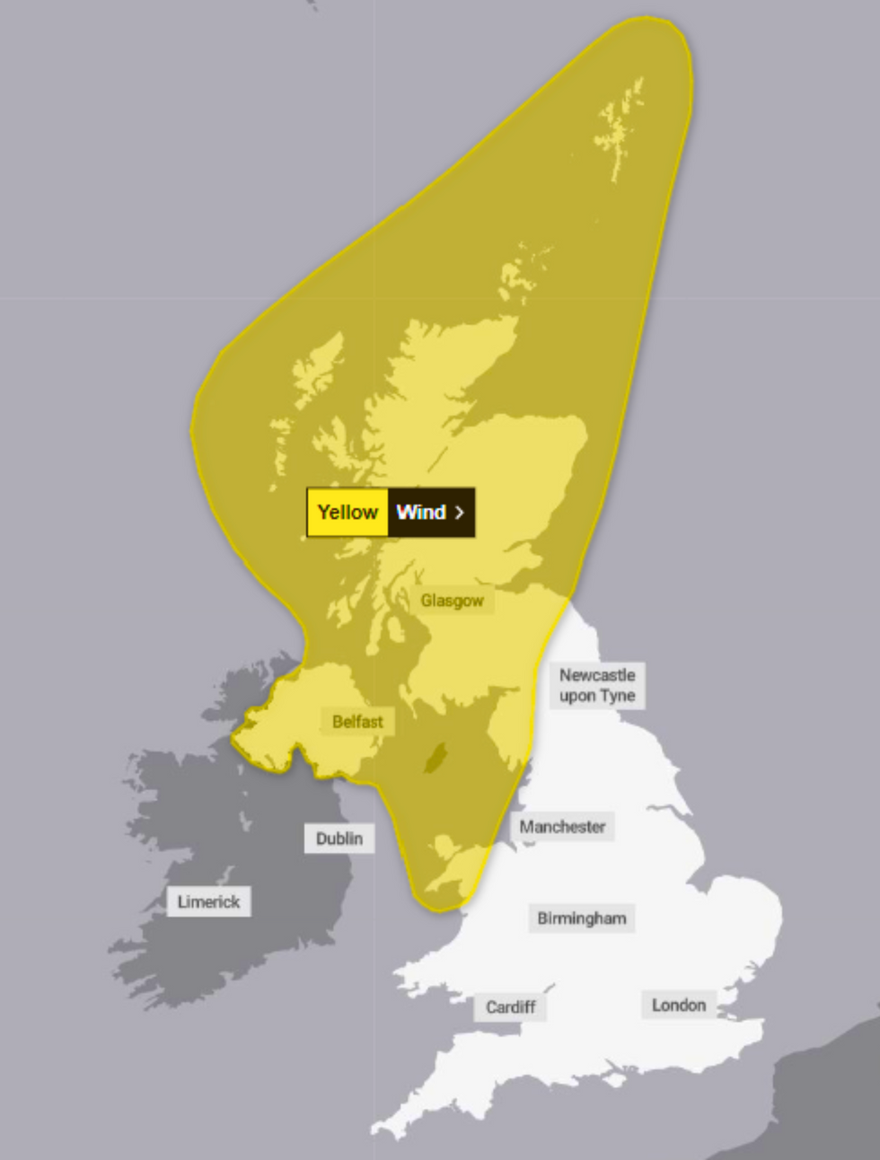
Sunday and Monday’s warning extends across parts of all four Home Nations
MET OFFICE
Wind speeds inland are set to range from 50-65 mph – but in western Scotland, this could soar to between 70 and 80mph.
These strong winds, the Met Office says, could again wreak havoc with public transport – and forecasters have even warned of slight chances of damage to buildings and danger to life.
The cause of the impending winds, Met Office deputy chief meteorologist Dan Holley says, is a “deep” low pressure system barrelling across the Atlantic.
Holley said: “A low pressure system could bring strong winds to the north and west on Friday.
MORE WEATHER NEWS:
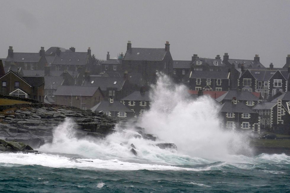
A particularly deep area of low pressure arriving from the Atlantic could bring more widespread strong winds, the Met Office said
PA
“This, combined with high spring tides, may result in some coastal impacts – potentially continuing into the weekend on some coasts.
“Warnings for Friday and later in the weekend have already been issued and will continue to be refined and reviewed in the coming days.
“As we head into the weekend the weather will remain unsettled with further rain at times, and by Sunday, there is a chance that a particularly deep area of low pressure arriving from the Atlantic could bring more widespread strong winds, especially in northern and western areas, with potential for some disruption in places.
⚠️ Yellow weather warning issued ⚠️
Strong winds across parts of Scotland, Northern Ireland, northwest England and northwest Wales
Sunday 0300 – Monday 1200
Latest info 👉 https://t.co/QwDLMfRBfs
Stay #WeatherAware⚠️ pic.twitter.com/yRlaLP7leM
— Met Office (@metoffice) October 16, 2024
“This low-pressure system is not expected to develop until Friday near the coast of Canada.
At this stage, there is still a lot of uncertainty about the strength and track of this system as it interacts with the jet stream over the weekend.
“It’s likely that Sunday’s wind warning will be updated and refined as confidence increases,” he added, urging the public to stay up-to-date with the latest weather forecasts.