A tornado warning has been issued for six areas of the UK, with Britons bracing for hail and lightning as storm clouds move in from the Atlantic.
The alert, issued by the Tornado and Storm Research Organisation, affects parts of England and the Channel Islands.
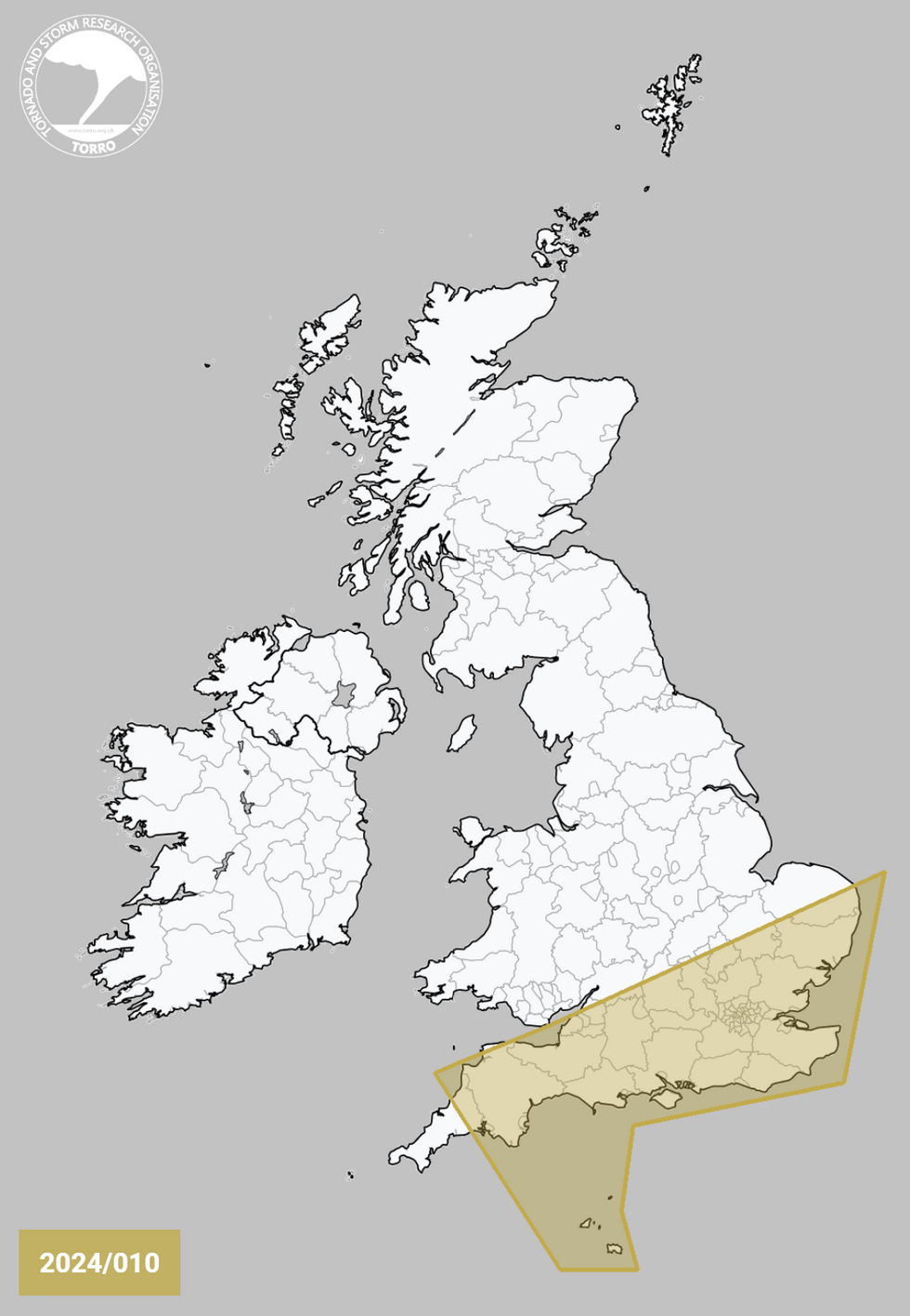
The areas at risk include South West England, Central South England, South East England, South Midlands, parts of East Anglia, and the Channel Islands.
Forecasters warn of potential travel chaos on Sunday evening as the severe weather system approaches.
The area set to be impacted by possible mesolows
PA/The Tornado and Storm Research Organisation
Gale-force winds up to 55mph are expected to sweep across the country, accompanied by heavy rainfall in some areas.
The Tornado and Storm Research Organisation provided details about the weather system, stating: “A shortwave trough will move ENE this afternoon/evening, accompanied by areas of showery rain, some convective in nature.
“One or more small-scale circulations (mesolows) may evolve, although model guidance differs somewhat on the exact morphology.”
They added that gusty winds, hail up to 1cm in diameter, and occasional cloud-to-ground lightning may accompany stronger storm cores.
The organisation warned that isolated tornadoes are possible, especially if mesolows form, which could produce “a more focussed risk corridor for gusty winds and occasional tornadoes”.
LATEST DEVELOPMENTS
The alert, issued by the Tornado and Storm Research Organisation, affects parts of England and the Channel Islands
Tornado and Storm Research Organisation
The Met Office forecasts an unsettled Sunday for much of the UK. A band of rain, potentially heavy at times, is expected to spread eastwards across the country.
Despite the blustery conditions and frequent showers, some sunny spells are also anticipated.
However, temperatures are set to be surprisingly mild for this time of year, with highs potentially reaching 18C.
The unsettled weather comes as the remnants of Hurricane Kirk approach Europe.
While the storm is expected to lose its hurricane status, it still poses a threat of disruptive rain and strong winds for parts of the UK from midweek onwards.
The six areas affected by the tornado warning are: South West England, Central South England, South East England, South Midlands, East Anglia and the Channel Islands.
Residents in these regions are advised to stay alert and monitor local weather updates.
The Met Office has not yet issued any specific warnings but is closely monitoring the situation.
Chris Bulmer, Deputy Chief Meteorologist at the Met Office, said: “The need for warnings will be kept under review over the coming days, so it’s important to stay up to date with the latest forecast.”