Parts of the UK could see snowfall as early as next week, according to the Met Office’s latest long-range forecast.
The unseasonal wintry turn comes in the wake of Hurricane Kirk which is expected to bring unsettled weather to British shores.
Whilst the hurricane will have weakened by the time it reaches the UK, it is predicted to continue as a “moderately deep low pressure system”, according to forecasters.
The Met Office‘s Deputy Chief Meteorologist Tony Wisson said: “Hurricane Kirk is currently in the tropical Atlantic.
Whilst the hurricane will have weakened by the time it reaches the UK, it is predicted to continue as a “moderately deep low pressure system”
MET OFFICE

As temperatures drop, Scotland and Northern Ireland may see the first signs of winter
PA
“It is expected to move north into cooler waters, where it will lose a lot of its strength, but maintain its identity as a moderately deep low pressure system.”
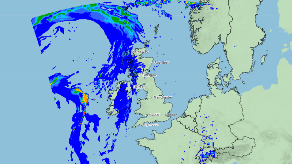
The coming days are expected to bring a mix of wet and windy conditions across the UK.
According to the Met Office, an Atlantic low pressure system will drift eastwards, bringing “widely unsettled conditions, with showers or longer spells of rain, heavy and persistent at times, especially over hills.”
Strong winds are also anticipated to buffet Britain, particularly in exposed coastal areas, while temperatures plunge to chilly averages of between 4-9C across the country.
LATEST WEATHER NEWS:
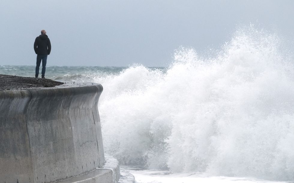
Strong winds are also anticipated to buffet Britain, particularly in exposed coastal areas
PA
As temperatures drop, Scotland and Northern Ireland may see the first signs of winter.
The Met Office forecast states: “Scotland and Northern Ireland are more likely to quickly turn colder with showers, and the colder weather (perhaps some sleet/snow on Scottish mountains) will most likely gradually work its way south following the clearance of ex-Kirk.”
The unsettled conditions are expected to persist throughout the rest of the month. The Met Office’s long-range forecast for 18 October to 1 November suggests: “A continuation of low pressure systems tracking in from the Atlantic is the most likely scenario for the rest of October.
“This means wet and windy weather at times, especially across England and Wales, but with a suggestion that Scotland and Northern Ireland may be more likely to see longer breaks in the weather, and more in the way of drier spells.”
Temperatures are predicted to be close to average in the south, but potentially below average in the north and northwest. There’s also an increased chance of overnight fog and frost as the month progresses.

Britons should brace for wet and windy weather, the Met Office warns
PA

“There is the potential for a coronal mass ejection to arrive at Earth late on Friday or early on Saturday,” the Met Office says
PA
In addition to the unsettled weather, the Met Office has announced the potential for aurora visibility in parts of the UK over the next few nights. This celestial display, though not expected to be as bright as the aurorae which stunned Britons earlier this year, is linked to recent spikes in solar activity.
Met Office Space Weather Manager Krista Hammond said: “There is the potential for a coronal mass ejection to arrive at Earth late on Friday or early on Saturday, which could lead to visible aurora for Scotland, Northern Ireland and parts of northern England.”
Hammond added: “In addition, we recently observed an X9 solar flare – the largest of this solar cycle so far.
“The accompanying coronal mass ejection is likely to arrive at Earth overnight on Saturday into Sunday, meaning that enhanced auroral visibility is possible further south across central England and similar latitudes, though cloud and rain could hamper viewing potential for some.”