Hurricane-hit America faces another hammering as the tropical Atlantic throws storm season into top gear.
As the nation reels from the devastation wrought by Hurricane Helene, ocean waters of the Gulf of Mexico are once again stirring.
A strengthening cyclonic disturbance in almost the same spot as Helene threatens to spawn a powerful tropical storm or hurricane.
Worried meteorologists have urged people living near the east coast of America to prepare for another terrifying blast of bulldozer gales and downpours.
 America faces threat of another devastating storm just days after Helene wreaks havocAccuWeather
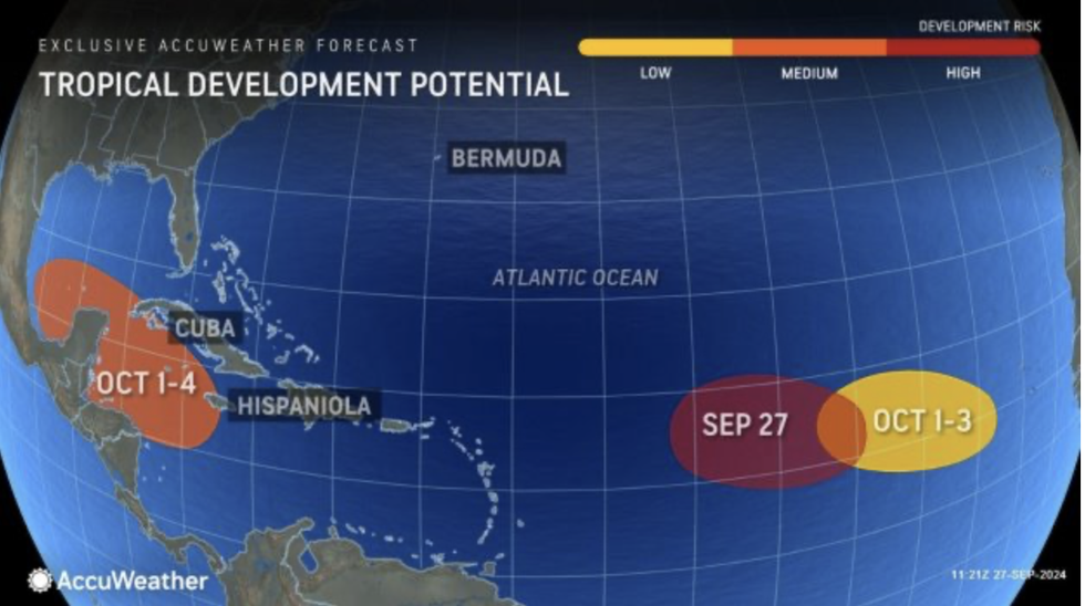
AccuWeather meteorologist Jon Porter said: “We are closely monitoring a moderate risk of potential tropical development in the northwest Caribbean and southern Gulf of Mexico.
“We’re concerned that clusters of showers and thunderstorms will form and likely organize into a tropical storm or even a hurricane that could move into the Gulf of Mexico later this week.
“Everyone along the US Gulf Coast needs to keep a very close eye on forecast updates.”
The next storm is likely to spawn in the Gulf of Mexico, close to where Category-4 Hurricane Helene erupted last week.
It would be the second major ‘home-grown’ disturbance to bubble up in a matter of days, unusual in not appearing further east near the coast of Africa.
US LATEST:
Florida is under a threat of ‘extreme danger’ from the storm, as the state faces a $100billion bill from Helene.
Porter said: “We could be dealing with yet another case of development close to the United States, rather than development out in the open Atlantic where we have more time to monitor and track a developing storm.
“Helene formed in this same area. We could be dealing with another hurricane next week.
“Should this next tropical system threaten Florida late next week, we could face extreme danger with this being on top of an unfolding disaster along the Gulf coast.”
It comes amid warnings for a particularly active hurricane season, with another three storms flexing their muscles in the tropical basin.
Hurricane Isaac and Tropical Storm Joyce are currently churning ocean waters in the Atlantic, with another possible storm reported within the last 24 hours.
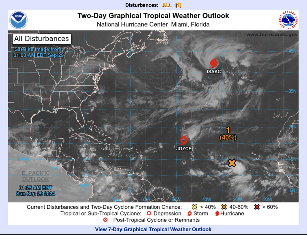
Storms brew in the Atlantic
NOAA
Isaac and Joyce are expected to veer north-eastwards away from the US, where the main threat comes from the Gulf of Mexico.
Jim Dale, US meteorologist for British Weather Services, and co-author of ‘Surviving Extreme Weather’, said: “The Gulf of Mexico is conjuring up another demon that threatens yet more bad weather through the latter part of this week.
“This comes just days after Helene, and it is the same region that is facing the impact of the potential storm.
“It looks, at the moment, like it will be the rain rather than the wind that will be the main issue with this one.”
The clean-up from Hurricane Helene is estimated to run past the $100billion mark, after the storm unleashed torrential downpours and devastating winds.
It could be one of the costliest storms in US history, the 460-mile storm’s vigour compounded by its sheer size.
Porter said: “AccuWeather estimates the total damage and economic loss from Hurricane Helene will be between $95billion and $110billion.
“Helene was a large and extremely powerful storm, with wind gusts of hurricane force extending far out from the centre through the Florida Peninsula and a devastating, even record storm surge all along the Gulf Coast of Florida as the storm headed northward over the eastern Gulf of Mexico.
“Catastrophic impacts also extended into the southern Appalachians, where flash flooding continues as does the risk of dam failures in some areas.”