Hundreds of miles of US coast are under threat from a mammoth storm surge as the US braces for 160mph Hurricane Helene.
A major tropical assault threatens to bulldoze eastern states ahead of the weekend, prompting a state of emergency.
Helene – last night upgraded to a Tropical Storm off the coast of Florida –would be the eighth of the season and could be one of the strongest.
The hurricane follows on from Alberto, Beryl, Chris, Debby, Ernesto and Gordon, and has sparked warnings for devastating winds and torrential floods.
A state of emergency has been declared in Florida where thousands of people have been told to evacuate their homes.
AccuWeather chief meteorologist Jon Porter said: “This is expected to be a large hurricane with a major storm surge threat and impacts that will reach hundreds of miles inland from where this storm makes landfall.
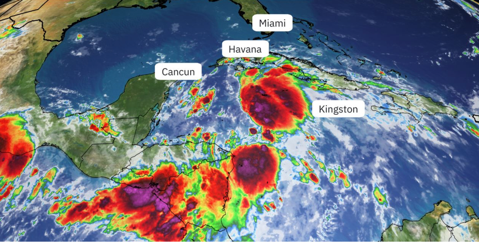 Helene builds off the east coastTHE WEATHER CHANNEL
“We expect significant flooding problems that could reach as far inland as Atlanta and potentially a secondary area of significant flooding in the southern Appalachians.”
Up to a foot of rain could fall in some parts triggering ‘extensive floods’, landslides and overtopping waterways.
People in the region are urged to prepare now and expect major disruption on roads and transport networks.
AccuWeather meteorologist Alex DaSilva said: “We expect significant flooding problems that could reach as far inland as Atlanta and potentially a secondary area of significant flooding in the southern Appalachians.
“Near where the centre of circulation makes landfall, wind gusts can reach 140mph to 150 mph with a maximum of 160 mph.
“These winds can cause significant structural damage near landfall and bring power outages that may last for weeks and damage or destroy buildings in its path.

Simmering ocean waters
The Weather Channel
“Winds of this magnitude take debris and send it flying into other objects, amplifying damage.”
The US National Hurricane Centre (NOAA) last night warned that ‘Potential Tropical System Nine’ – the system that threatens to grow into Helene – was intensifying.
It is expected to grow stronger still through the middle of the week before reaching hurricane status later on Wednesday or Thursday.
A NOAA spokesman said: “The system is expected to intensify into a major hurricane before it approaches the north-eastern Gulf Coast on Thursday.
“The disturbance is forecast to intensify when it reaches the far north-western Caribbean sea on Tuesday night.”
Chris DeWeese, spokesman for The Weather Channel, added “If you or your loved ones live on the Gulf Coast from Florida to Louisiana, you should be watching this thing closely, and making your preparations for a possible hurricane landfall later this week.”

Hundreds of miles of US coast are under threat
ACCUWEATHER
Impacts from the storm are expected into the weekend, with warnings for strong inland gusts and heavy rain.
The storm is being driven by unusually warm ocean temperatures in the Caribbean Sea and the Gulf of Mexico.
Ocean heat, at record levels for the time of year after the US heatwave summer, will feed Helene on her journey.
Weather Channel meteorologist Jonathan Erdman said: “Helene is forecasted to reach major hurricane intensity in the Gulf ahead of landfall.
“That’s because heat content is one favourable ingredient for intensification, and there is plenty of deep, warm water in the northwest Caribbean Sea and parts of the Gulf of Mexico.”
Jim Dale, US weather correspondent for British Weather Services and co-author of ‘Surviving Extreme Weather’, said: “Ocean temperatures in parts of the region are at record highs, and this feeds the formation of tropical storms and hurricanes.
“This is in line with a general warming of the climate, and the higher incidence of seeing these types of powerful storms.”