America’s savage weather is about to step-up its assault with a major storm to smash the country on the night of the blood moon.
Millions of stargazers hoping to catch the first scarlet eclipse for three years face raging winds, rain, snow and a shroud of blanketing cloud.
A huge Pacific storm ploughing through the west coast has sparked yet another raft of warnings for torrential downpours and snow.
AccuWeather meteorologist Brian Lada said: “A massive storm moving in from the Pacific is expected to spread rain, mountain snow, and clouds across the West Coast, Rocky Mountains, and northern Plains, making it challenging to see the total lunar eclipse.
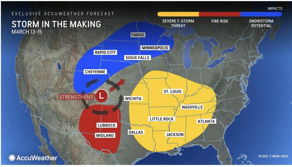
A huge Pacific storm ploughing through the west coast has sparked yet another raft of warnings for torrential downpours and snow
ACCUWEATHER
“Millions of people will be able to watch the moon turn red if they stay up, but cloudy and stormy weather could obstruct the show for sky gazers in several regions.
“The good news is the total lunar eclipse will last for more than an hour, much longer than the total solar eclipse last April, which lasted less than five minutes along the path of totality.”
The lunar eclipse on Thursday will mark the Earth’s passing directly between the Sun and the Moon.
Radiation from the Earth casts a rusty, blood-splattered shadow across what appears as a blood moon.
Southern stargazers will fare best with the clearest skies predicted across Texas, the Ohio Valley, and southern Florida.
Lada said: “Poor viewing conditions are expected across the Rockies and Northern Plains.
LATEST DEVELOPMENTS:
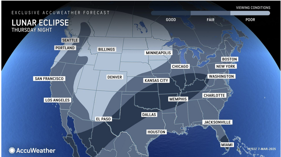
Southern stargazers will fare best with the clearest skies predicted across Texas, the Ohio Valley, and southern Florida
ACCUWEATHER
“The best weather conditions to enjoy the event are expected from Texas to the Ohio Valley, as well as southern Florida. You only need a few breaks in the clouds to witness the total lunar eclipse.”
The US National Weather Service (NOAA) has issued further winter-weather warnings across northeastern states.
Separate wind warnings are in force across the Canadian border and surrounding regions with dry gusts adding a wildfire threat.
Storms hitting the Gulf Coast at the start of the week threaten strong winds, showers and the risk of thunderstorms.
A NOAA spokesman said: “A Gulf Coast low pressure system is forecast to spread scattered showers and thunderstorms across the Southeast.
“Isolated flash flooding is possible with between two and four inches expected from the Florida Panhandle to the Southeast Coast by Tuesday morning.
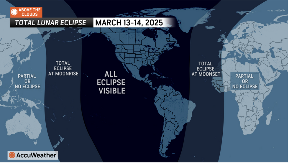
The lunar eclipse on Thursday will mark the Earth’s passing directly between the Sun and the Moon for the first time in three years
ACCUWEATHER
“Flood Watches are in effect along portions of the Georgia-Florida border.”
Stormy weather will be driven in part by the return of Arctic winds sweeping through Canada into the US.
Temperatures to the north of the country will drop below freezing this week while the mercury rises to the south.
The clash of air masses will continue to fuel the barrage of storms which has blighted the US since late winter.
Jim Dale, US meteorologist for British Weather Services and co-author of ‘Surviving Extreme Weather’, said: “Cold air pushing down from the north will cascade into low-pressure systems and frontal systems brining the ongoing risk of storms.
“Once that cold air comes in, it meets with the warmer air from the tropics and that is where you get the risk of storms.”