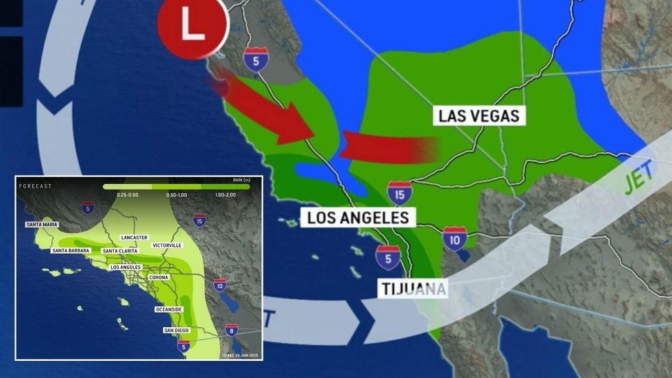
A wave of ‘toxic floods’ triggered by a powerful Pacific storm will sweep communities devastated by deadly wildfires.
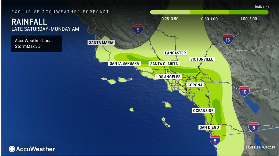
California and Pacific states are on alert for inundating downpours as a rapidly deepening cyclone rages off the west coast.
The deluge will quench lingering embers from the fires, although heavy rain on ‘burn-scarred’ land will run off in torrents.
The region faces mudslides and rivers of floodwater loaded with pollution and debris left from the fires, experts warn.

A wave of ‘toxic floods’ triggered by a powerful Pacific storm will sweep communities devastated by deadly wildfires
AccuWeather
Jim Dale, US meteorologist for British Weather Services, said: “Heavy rain will arrive this week to regions that have been devastated by wildfires.
“Floodwater hitting these regions will have picked up debris and remains from the wildfires, carrying this through areas where the barrier from trees and shrubs has been destroyed, leaving them susceptible.
“As they pick up this debris and pollution from the fires, the floodwaters will become toxic as they travel to communities where life has already been left unbearable from the fires.”
Heavy rain will be driven by a powerful Pacific storm gaining strength to the southwest of the US coast.
Downpours will hit land ‘scarred’ from the recent fires, triggering flash floods and mudslides.
Over higher ground rain could fall as snow, prompting the US National Weather Service (NOAA) to issue winter storm warnings.
LATEST DEVELOPMENTS:
A spokesman said: “This is going to produce moderate accumulating snow for the central and southern Sierra, as well as the highest terrain of southern California.”
The greatest risk, however, will be from torrential downpours and floods hitting parched land, he warned.
He said: “While most of this rainfall should be greatly beneficial, any heavier showers than fall directly over recent burn scar areas could lead to instances of flash flooding and mudslides, and therefore, a marginal risk of flooding is valid for the Transverse and Peninsular Ranges.
“A more concentrated corridor of heavy rain is expected from south-eastern Texas to central Mississippi through Monday morning, with some locations getting one to two inches with locally heavier amounts possible.”
California has been left bone-dry having seen no rain since October before being ravaged by fires.

California and Pacific states are on alert for inundating downpours as a rapidly deepening cyclone rages off the west coast
AccuWeather
People living near fire-scarred regions stripped of trees and vegetation are most at risk from floods, experts warn.
AccuWeather meteorologist Heather Zehr said: “Too much rain falling too quickly in burn scar areas could cause serious problems.
“Intense flames and heat from recent wildfires have weakened and destroyed vegetation that anchors the soil.
“Rainfall that would normally be absorbed by the soil can quickly runoff of scorched areas.
“People near burn scar areas need to be aware of the threat that dangerous debris flows, and mudslides are possible.”
Rain falling on fire-damaged ground could wash ash and debris onto roads and into waterways, she added.
She said: “Rain falling on ash, debris, dust and chemicals could cause slick roads and sidewalks in and around burn scar areas. Runoff from heavy rainfall could also carry ash and toxic contaminants out of burn scar areas, potentially reaching waterways.”