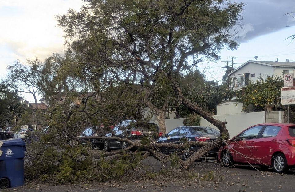
Winds began gaining strength across Southern California on Tuesday, as forecasters warned of “life-threatening, destructive” gusts that could last for days, toppling trees, creating dangerous surf and bringing extreme fire risk to areas that have not seen substantial rain for months.
The US National Weather Service said what could be the strongest Santa Ana windstorm for more than a decade would begin in the afternoon across Los Angeles and Ventura counties and peak in the early hours of Wednesday, when gusts could reach 80mph (129kph). Isolated gusts could top 100mph (160kph) in mountains and foothills.
The weather service warned of possible downed power lines and knocked-over big rigs, trailers, and motorhomes.
Firefighters responded on Tuesday morning to a handful of small blazes burning near homes in LA County.
A fallen tree blocks a street amid strengthening winds in Los Angeles (Christopher Weber/AP)
The upcoming winds will act as an “atmospheric blow-dryer” for vegetation, bringing a long period of fire risk that could extend into the more populated lower hills and valleys, according to Daniel Swain, a climate scientist with the University of California, Los Angeles and the National Centre for Atmospheric Research.
“We really haven’t seen a season as dry as this one follow a season as wet as the previous one,” Mr Swain said during a livestream. “All of that extra abundant growth of grass and vegetation followed immediately by a wind event of this magnitude while it’s still so incredibly dry, elevates the risk.”
Recent dry winds, including the notorious Santa Anas, have contributed to warmer-than-average temperatures in Southern California, where there has been very little rain so far this season.
Southern California hasn’t seen more than 0.1 inch (0.25cm) of rain since early May. Much of the region has fallen into moderate drought conditions, according to the US Drought Monitor. Meanwhile, in the north there have been multiple drenching storms.
Areas where gusts could create extreme fire conditions include the charred footprint of last month’s wind-driven Franklin Fire, which damaged or destroyed 48 structures, mostly homes, in and around Malibu.
The blaze was one of nearly 8,000 wildfires that added up to scorch more than 1,560 square miles (more than 4,040 square kilometres) last year.
The last wind event of this magnitude occurred in November 2011, during which more than 400,000 customers lost power across LA County, the Los Angeles Times reported.
Elsewhere, the plunging polar vortex brought subfreezing temperatures on Tuesday to some of the southernmost points of the US, threatening to dump snow on parts of Texas and Oklahoma in the coming days and contributing to a power outage in Virginia’s capital that made the water unsafe to drink.
The arctic blast that descended on much of the US east of the Rockies over the weekend has caused hundreds of car accidents, thousands of flight cancellations and delays, and led communities to set up warming shelters, including one at a roller rink.
As the cold front moved southward Tuesday, it prompted a cold weather advisory for the Gulf Coast and pushed the low temperature in El Paso, along Texas’s border with Mexico, to 31 degrees (minus 0.5C), with an expected wind chill factor ranging from 0 to 15 degrees (minus 18 to minus 9C) early on Wednesday, according to the National Weather Service.
