The Met Office has issued seven weather warnings across the UK after a night of heavy snowfall – with travel chaos unfolding on Britain’s roads and runways as a result.
The warnings, which stretch from Land’s End to John O’Groats, tell Britons to brace for snow, ice and rain, while transport bodies have shut off roads around Britain because of snow, flooding or crashes.
The warnings are expected to come to an end between 9am and midday today – but throughout the morning, freezing temperatures are taking hold as far south as the West Midlands, while rain warnings are in place from Cornwall to north of the Humber.
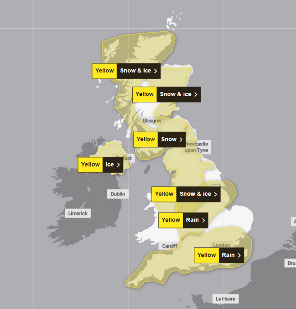
Across Britain, the Met Office has issued:
- Three yellow snow and ice warnings – western Scotland (midday on Sunday to 11am on Monday), eastern Scotland (9am to midday on Monday), Scottish borders to West Midlands (midnight to midday on Monday);
- One yellow snow warning – Edinburgh to Scottish borders (midnight to midday on Monday);
- One yellow ice warning – Northern Ireland (midnight to 11am on Monday);
- Two yellow rain warnings – East Midlands and South Yorkshire (6am on Sunday to 10am on Monday), southern England (8.51am on Sunday to 9am on Monday).

The warnings are expected to come to an end between 9am and midday today – but throughout the morning, freezing temperatures are taking hold
MET OFFICE
The Met Office warns of snow accumulations of 5-10cm in places across northern England and North Wales, with rain turning to snow at lower levels, particularly over northeast Wales and northern parts of the Midlands.
Icy stretches are expected to develop widely, making for difficult travelling conditions.
In the Scottish Borders and southern Lothians, snowfall could reach 10-20cm over higher ground, with rain or sleet more likely near eastern coasts.
While the Environment Agency has increased its flood warnings across England from 139 to 146, stretching from Yorkshire to southwest England.
LATEST WEATHER UPDATES FROM GB NEWS:

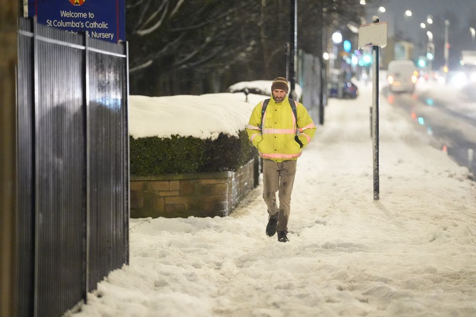
A man walks through snow in Bradford this morning
PA
An additional 288 flood alerts are in place, indicating flooding is “possible” in these areas.
The Met Office cautions that as precipitation clears eastwards on Monday morning, ice is likely to form on untreated surfaces, creating further hazards for travellers.
These conditions are expected to create particularly challenging conditions for morning commuters – but the weather has already wreaked havoc on the first Monday of 2025.
Manchester Airport has now reopened its runways after earlier closures due to severe weather, though delays to departures and arrivals continue.

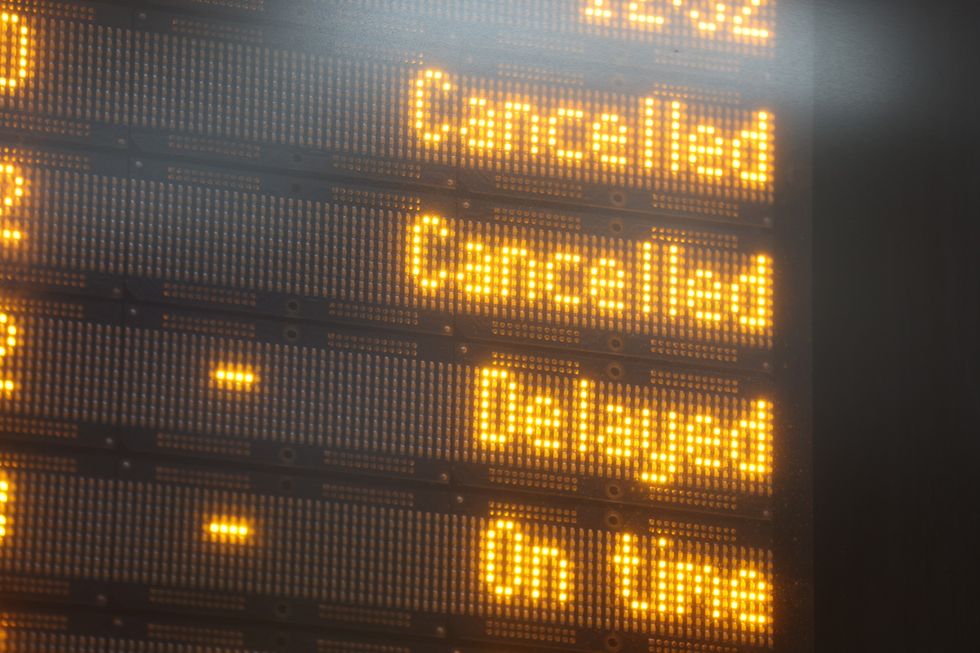
Rail networks across Britain are experiencing severe disruption (file photo)
PA
While National Highways reports multiple A-road closures across England, including the A66 in Cumbria due to snow and the A628 Woodhead Pass because of flooding.
The A1 in Lincolnshire and A49 in Herefordshire are both closed due to flooding.
In Derbyshire, the A38 northbound is shut following a crash, while the A46 in Warwickshire is closed after a car reportedly aquaplaned due to flooding.
Motorists are advised to check routes before travelling and allow extra journey time.
Rail networks across Britain are experiencing severe disruption, with multiple line closures and service suspensions.
All lines between Peterborough and Leicester are closed, while Merseyrail services to Chester and Hooton have been suspended due to flooding near Hooton.
Flooding at Elton and Orston is affecting journeys between Nottingham and Grantham, with further disruption between Worcester Shrub Hill and Hereford.
And South Western Railway is advising passengers not to travel between Woking, Basingstoke and Southampton due to electrical supply problems.