Ferries and trains have been disrupted as snow, rain and wind warnings are in force and are expected to cause further travel issues on New Year’s Eve.
Almost every part of the country is covered by at least one of the multiple weather warnings that have been issued by the Met Office between Monday and Wednesday.
Scotland is being hit first by “fairly persistent rain” and snow, with 50-70mm of rainfall expected widely, 100-140mm in some locations, and up to 20cm of snow in places, with a warning in place until midnight on New Year’s Eve, the forecaster said.
Ferry routes have already been disrupted in Scotland on Monday, while rail lines have been affected including the Highland Main Line at Kingussie.
We need your consent to load this Social Media content. We use a number of different Social Media outlets to manage extra content that can set cookies on your device and collect data about your activity.
And an amber warning has been issued for parts of Scotland between midnight and 5pm on New Year’s Eve, indicating that heavy rain is likely to cause property flooding and some travel disruption.
A yellow warning has been issued for “persistent snow” likely to cause road disruption in Orkney and Shetland from 5am until midnight on Tuesday.
Met Office spokesman Oli Claydon said: “There will be pretty severe weather from that rain over the next 48 hours.”
He also advised residents to check flood alerts on the Scottish Environment Protection Agency’s website.
Meanwhile, northern England has started to be battered by blustery conditions, which are set to include gusts of up to 60mph on Monday, according to the forecaster.
A weather warning is in place on Monday where strong winds could impact travellers until 6pm in areas including Durham, Northumberland, Cumbria and North Yorkshire.
On New Year’s Eve, delays to all types of transport are “likely” as strong winds persist and may reach speeds of up to 70mph in England and Northern Ireland, the forecaster warned.
We need your consent to load this Social Media content. We use a number of different Social Media outlets to manage extra content that can set cookies on your device and collect data about your activity.
An alert for wind is in place from 7am until 11pm on Tuesday and covers just north of York in England up to Glasgow, Edinburgh and Greenock, while the alert covering much of Northern Ireland is in force between 6am and 2pm.
Mr Claydon said the weather impacts will be varied across the UK, with “a wet and windy spell for many up into the new year”.
He added: “There’s already some travel disruption in Scotland because of the high totals they’re seeing, more broadly there could be disruption from strong wind and, in particular, where the wind and rain overlap.”
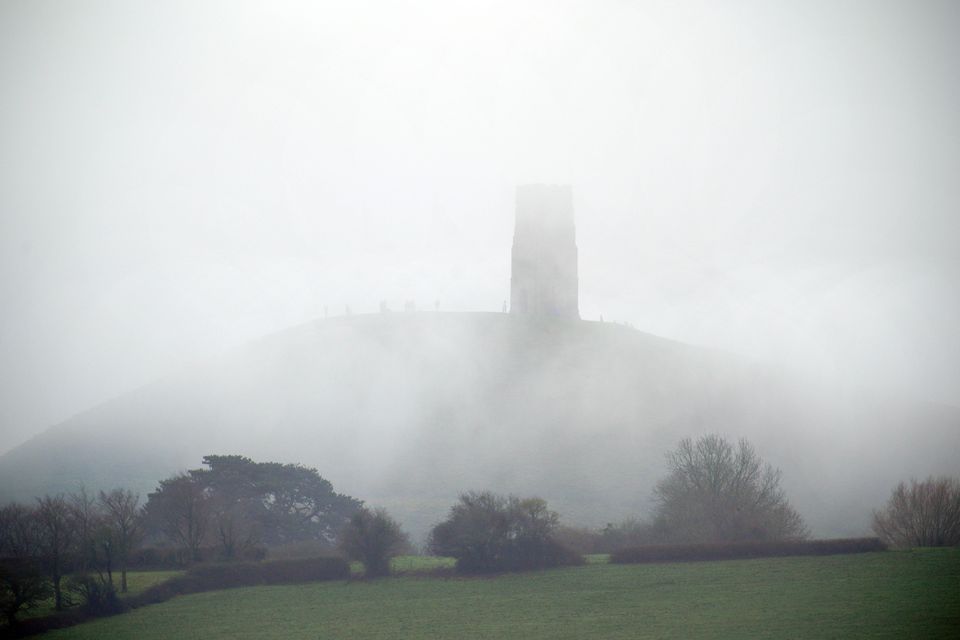
Foggy conditions at St Michael’s Tower on top of Glastonbury Tor, Somerset, ahead of New Year celebrations (Ben Birchall/PA)
The new year will be off to a turbulent start with separate weather warnings in place for wind and rain on January 1.
Very strong winds of up to 60mph are forecast across the whole of England and Wales all day on Wednesday, with gusts of 75mph likely around coastal areas and hills, according to the Met Office.
The warning for wind is in place from 7am until midnight on Wednesday and the rain warning covers Wales and north-west England between 6pm on New Year’s Eve and 6pm on Wednesday, with 30-50mm expected widely and a chance a few locations could see in excess of 100mm of rainfall.
The remainder of the week will be much colder, with widespread frost across the country predicted on Thursday night, the forecaster added.
