A turbo-charged jet stream will suck freezing winds from the north into freak southerly heat driving a ‘temperature rollercoaster’.
The US is about to become a nation divided with snow and sub-zero gales to blitz upper states while further south gets ready for a blast of warmth.
A ‘tug-of-war’ at the collision point will unleash ferocious storms with stormy weather forecast into Christmas.
Southern, southwestern and some eastern regions will see thermometers hover above average through the coming weeks, while the north-east freezes.

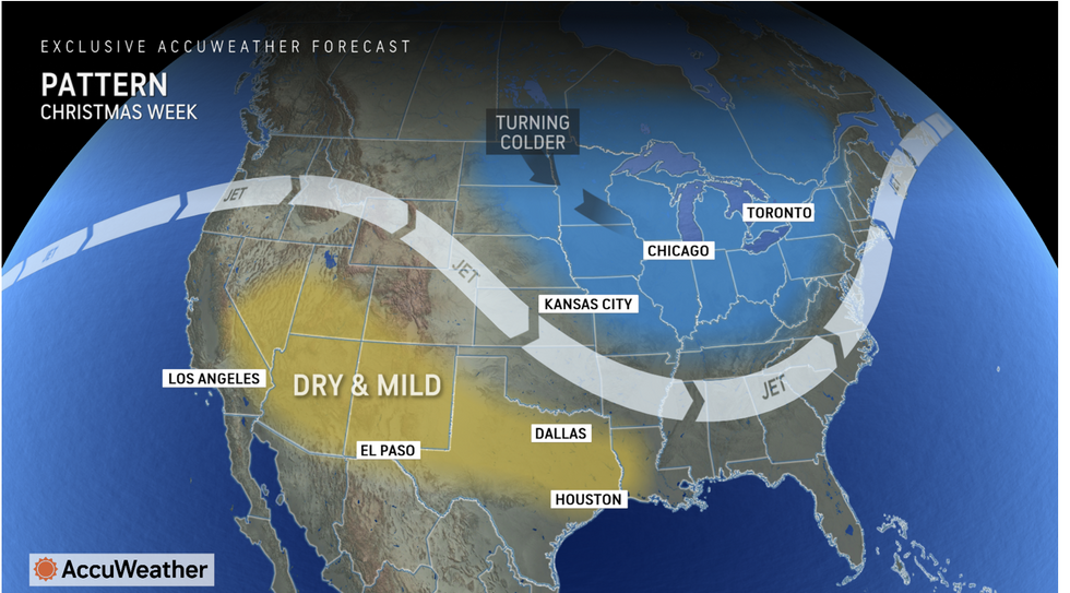
America is set to be divided with a jet stream running through it
AccuWeather
AccuWeather meteorologist Paul Pastelok said: “Get ready for a lot of ups and downs.
“The winter Forecast features dramatic pattern shifts and a temperature roller coaster, with above-average temperatures expected across much of the eastern, central and southwestern United States.
“The pattern is flipping, with a thaw and mild air across much of the eastern and central US, but we’re going to see waves of colder air through the winter season.”
Torrential rain will hit central and eastern Gulf coast states this week while heavy snow grips north.
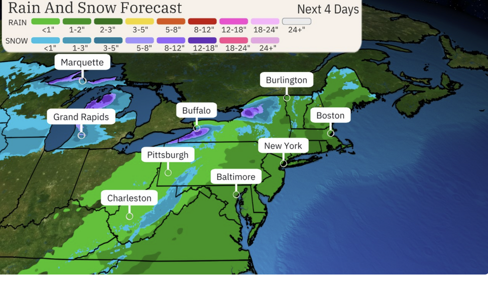
Mild air gusting across the Great Lakes will trigger blizzards with surrounding regions risking a ‘lake-effect’ whiteout.
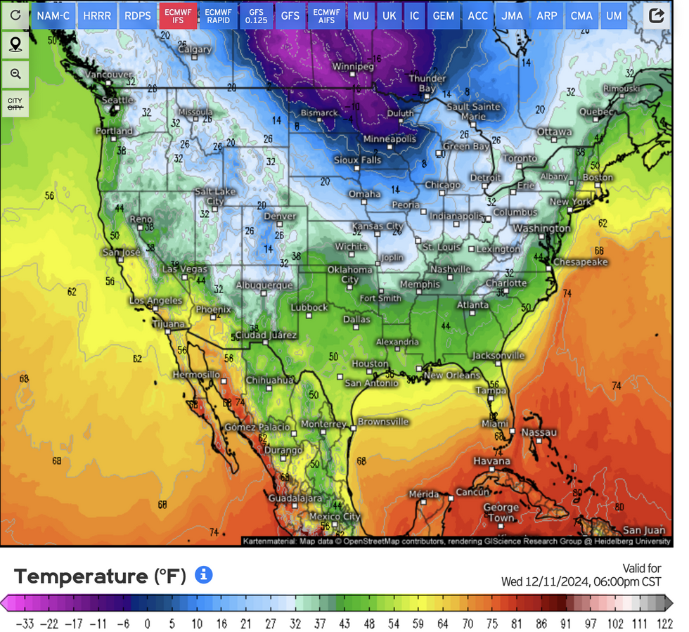
A gush of Arctic air will plummet mid-week temperatures with clashing airmasses to trigger an explosive deluge.
A spokesman for the National Weather Service (NOAA) said: “There is potential for some very strong thunderstorms to form ahead of the front together with heavy downpours.
LATEST DEVELOPMENTS:

The northeast will be particularly hard hit
The Weather Channel
“Meanwhile, drastically colder air behind the front is forecast to produce accumulating snowfall up the western slopes of the Appalachians on Wednesday together with blustery north-westerly winds.
“Active Lake effect snows begin on Wednesday and continue through Thursday downwind of the Lakes, and by Thursday morning, the next round of coastal rain and mountain snow will reach northern California as the next Pacific cyclone arrives.”
The heaviest rain will hit the northwest Pacific states, as the weather ‘flips’ between mild and cold.
Competing air masses will be steered by a powerful jet stream spanning the US, pulling the cold from the north while the south warms.
Heavier snow is likely towards the end of the month before a surge of warmth sets off another thaw.
Mr Pastelok said: “Snow and colder air in late December would be welcome news at ski mountains across the country during the busy holiday season between Christmas and New Year’s Day.
“Then we expect late January to be mild and even warm along the Gulf Coast and into the Tennessee Valley, with the potential for severe weather to occasionally rumble, feeding off the mild air and moisture from the Gulf of Mexico.

Cold from the north meets mild from the south
Weather.us
“Following a frigid start to December across much of the eastern United States with feet of lake-effect snow near the Great Lakes, we are now forecasting a temperature tug-of-war.”
The threat of a big thaw comes after a snow deluge at the start of the month left north-eastern regions buried under feet of snow.
A collision between hot and cold air has driven one of the United States’ most severe lake-effect snowfalls.
Americans are warned to expect no let up from this pattern through the festive season and into 2025.
Jim Dale, US meteorologist for British Weather Services and co-author of ‘Surviving Extreme Weather’, said: “Temperatures are going to be up and down through the end of the year, and this is due to a frontal system moving across the country.
“This will bring a period of interesting weather, with the threat of more snow, thaw, and then heavy rain.”