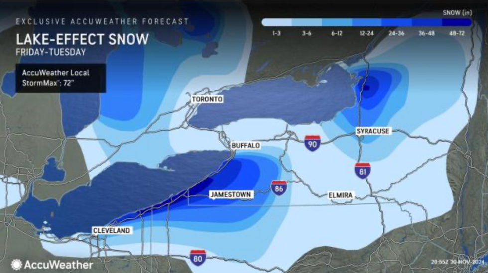
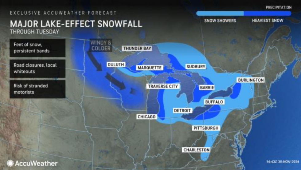
A ‘jaw-dropping’ winter deluge wielding the potential for the ‘heaviest snowfall in the world’ threatens to bury parts of the US under an impassable snowdrift.
Eastern states are on alert for ‘prolific’ blizzards, prompting warnings to brace for ‘impossible’ travel conditions.
Arctic winds this week will send a freezing plume across the warm waters of the Great Lakes triggering an eruption of instability.
A resulting savage ‘snow squall’ threatens to engulf the region and surrounding states as experts warn of a winter blanket piling feet deep.

Eastern states are on alert for ‘prolific’ blizzards, prompting warnings to brace for ‘impossible’ travel conditions
AccuWeather
Weather Channel meteorologist Chris DeWeese said: “A classic combination over the Great Lakes over the next several days looks to be setting up and will be capable of producing jaw-dropping snow totals.
“The water in the Great Lakes is not yet frozen and is still quite warm, and as an Arctic outbreak of frigid air pours down from Canada, the lake moisture and instability from this temperature contrast will build bands of snow that then get deposited downwind from the lakes.”
An unusually savage cold snap sweeping still warm waters over the Great Lakes will give rise to ‘towering’ snow clouds.
After an unusually hot summer, lake-water temperatures are still higher than usual for the time of year.
AccuWeather meteorologist Brandon Buckingham said: “With water temperatures of the lakes still averaging in the lower to middle 50Fs, and air blowing over the lakes expected to be in the teens, 20Fs and lower 30Fs, towering clouds will form and align in streets or bands that produce heavy snow.
“Thunder and lightning can occur in the most intense bands with strong wind gusts.
“The difference in temperature between the air and the waters of the Great Lakes produces lake-effect, and the greater the temperature extreme, the more intense the snow can be.
“The Great Lakes, as a whole, are close to or slightly above the warmest they have ever been on this date.”
Lake-effect snow can produce some of the heaviest snowfall in the world as temperatures drop rapidly over moisture-laden waters.
Cold air from Canada sweeps the world’s largest lakes birthing bands of snow which sweep onland.
Rapid snowfall brought six inches in just 30 minutes to parts of New York in 1966 and almost 18 inches in two hours in 1972.
Weather Channel meteorologist Jonathan Erdman said: “The Great Lakes snowbelts are home to some of the heaviest snowfall in the world.

Eastern states are on alert for ‘prolific’ blizzards, prompting warnings to brace for ‘impossible’ travel conditions
AccuWeather
“That’s due to prolific lake generated snow events that can produce feet of snow over several days.
“Lake moisture and instability from a temperature contrast build one or multiple bands of snow, which are then deposited over locations downwind from the lakes, from upstate New York to upper Michigan.”
Heavy snow is forecast across north-eastern states as far as New York through the next week.
Another burst of cold ahead of the weekend will trigger a further deluge before the snow eases.
Jim Dale, US meteorologist for British Weather Services and co-author of ‘Surviving Extreme Weather’, said: “There is a second plume of cold from Canada at the end of the week, and this will bring more cold air over the Great Lakes and further snowfall.
“Beyond the next week, it is the snow is likely to ebb and become less severe as we go through the first week of December.”
A spokesman for the National Weather Service added: “Heavy lake-effect snow bands and snow showers have developed downwind of the Great Lakes and will continue into this week.
“Travel could be very difficult to impossible.”