A pressure dome wedged over Britain will drive another week of cloudy calm before a crack in its armour ushers the first taste of winter.
Stubborn high pressure behind the settled, gloomy weather shows no signs of weakening through into mid-month.
Rainless, still skies will persist after the weekend, although a ‘cleaner’ pattern will see mist and murk replaced by sunshine and above-average temperatures.
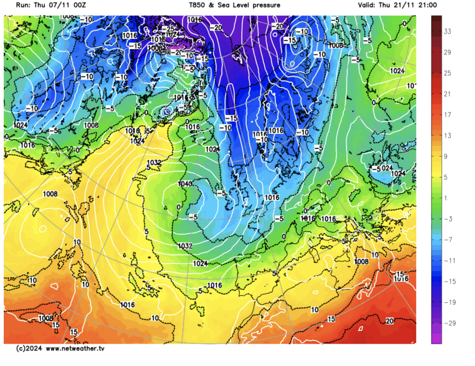
But a chilly change is afoot, with easterly and north-easterly winds threatening to end the balmy spell with bitter nights, frosts and even snow.
 Cold air floods into BritainNetweather
James Madden, forecaster for Exacta Weather, said: “The continued mild November weather with a mixture of gloomy and sunny days looks like it is about to give way later in the month to the risk of wintry blasts and some early snow.
“These changes are likely to happen after the middle of November and would last for several days during late November.
“Our long-range forecasts have ‘weak to moderate’ confidence for further stormy conditions to potentially coincide with cold from the north, and this would deliver one or two early wintry blasts through the second half of the month.”
In the meantime, a high pressure ‘anticyclone’ will dig its heels over the UK, driving more fine weather.
Apart from a touch of drizzle, most of the country will stay dry and warmer than the past week.
LATEST DEVELOPMENTS:

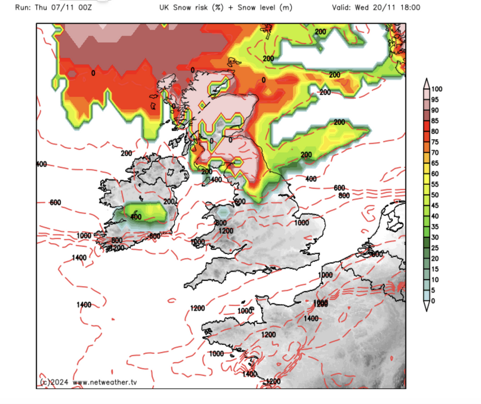
Risk of snow
Netweather
Rather than grey, cloudy skies, the Met Office said a ‘cleaner’ weather pattern could bring a return of the sun.
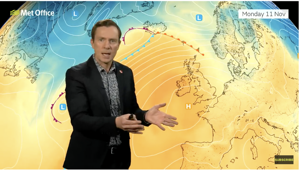
Met Office meteorologist Alex Deakin said: “For the start of next week, high pressure is dominating with the jet stream pushing to the north and arching over the UK taking weather systems with it towards Iceland.
“This high pressure looks quite a lot ‘cleaner’, as we say in meteorological terms, and that means there is not as much moisture in it, and there won’t be as much cloud, so there is a much better chance through the early part of next week of actually seeing some blue sky rather than grey sky.
“High pressure dominates our weather for the early part of next week with warmer air wafting further north.”
Temperatures will stay above average, particularly in Scotland as dry winds tumble over mountains – the ‘foehn effect’.

Met Office’s Alex Deakin describes how high pressure over the UK will bring warmer weather
Met Office
However, nights will be cooler and as pressure shifts ahead of the weekend, much of the country could turn cooler.
Deakin said: “Northern Scotland will have some sunshine over the next couple of days and as a result, it will be warmest here, with the highest temperatures over northern Scotland helped by something called the foehn effect the winds bouncing over the mountains.
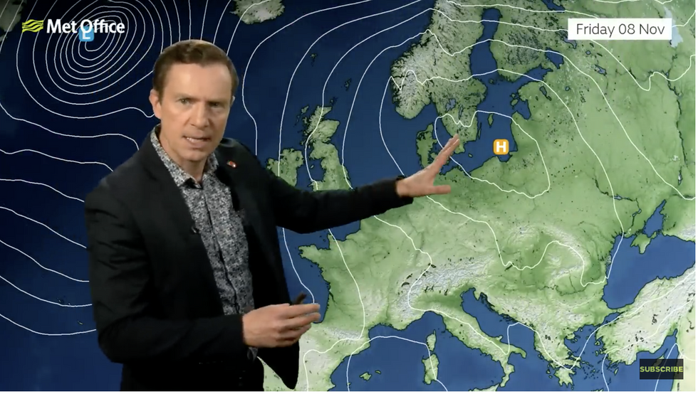
“The position of the high next week is crucial to the type of weather and what’s most likely is that high pressure will be close by and controlling our weather, but this pressure will be to the west with winds coming in from the north.
“Slightly cooler air will push in, and by the time we get to Friday low pressure is getting a little closer suggesting the winds could start coming in from the east and the northeast.”

But then it shifts, warns Deakin
Met Office
While a winter blast is not on the cards just yet, it will feel largely cooler than of late, he added.
Weather models suggest that parts of the country could see the first snowfall before the end of the month.
Jim Dale, meteorologist for British Weather Services and co-author of ‘Surviving Extreme Weather’, said: “The outlook in the short-term is for high pressure to stick around and so there is not going to be any real change from what we have seen so far through the start of November.
“But there is a chance that this pattern could switch, and this would bring the risk of colder weather and snow, but these are likely to be sporadic and short-lived bursts.”