A blast of Indian-Summer warmth will see trick or treaters swelter in possibly the hottest Halloween on record.
Southerly winds will push thermometers to 80F-plus this week under a ‘blocking’ high-pressure heat dome.
Eastern states face an ‘exceptionally’ warm end to October as gusts sweep in from the tropics.
Jim Dale, US meteorologist for British Weather Services, said: “Instead of a traditional Halloween, we are more likely to get an Indian summer with some exceptionally warm temperatures on the way.
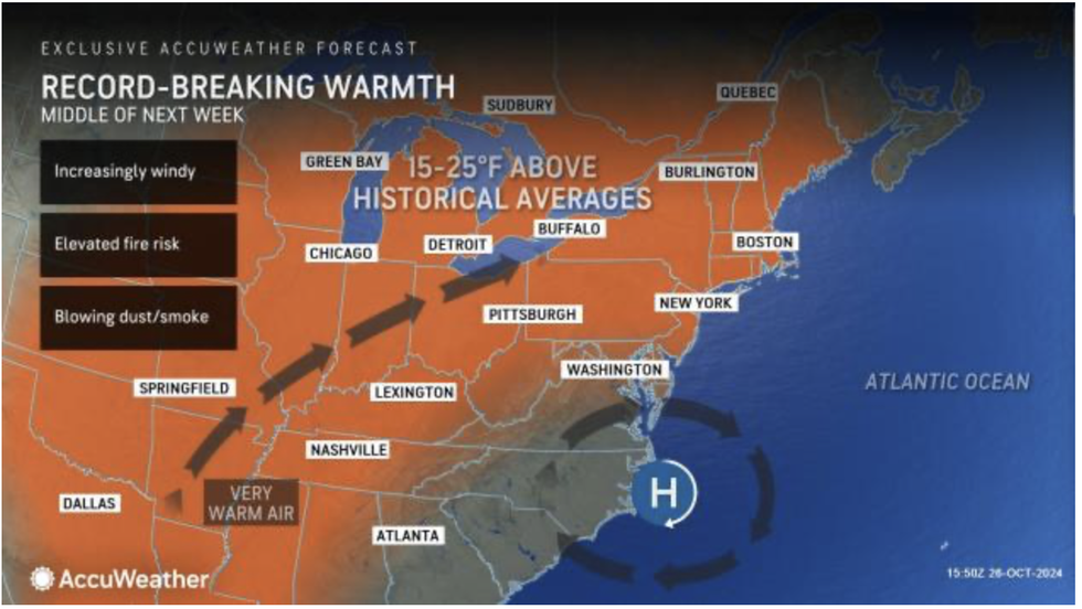
Eastern states will bear the brunt of the heat
AccuWeather
“Eastern and north-eastern states are going to get the warmest weather and if we hit 27C or above, it is likely that records will be broken.
“This warmth is spreading right up to New York, Washington DC and New England.”
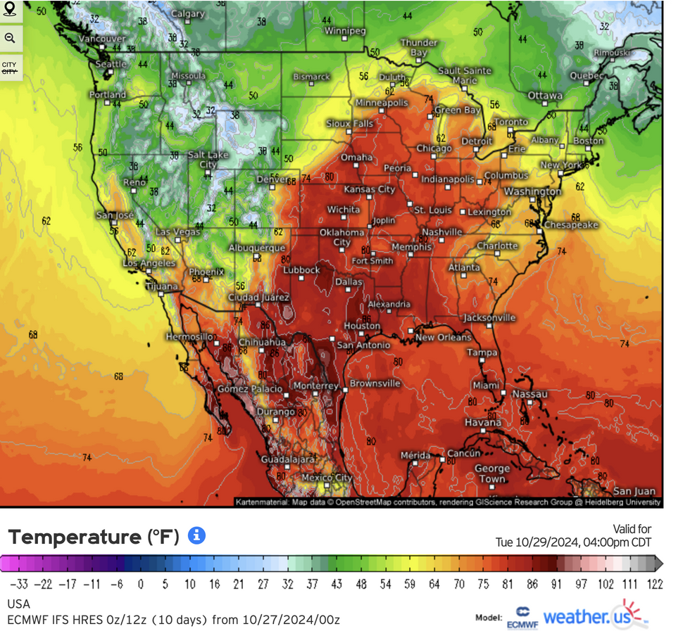
However, temperatures on the other side of the country will plunge as chilly winds spill in from Canada.
High pressure – similar to the heat-dome driver of the summer heatwave – to the east will on its edge, draw cold winds from the north.
Mr Dale said: “While the east is going to get the warmth under high pressure, to the west there a northerly airflow, and this will bring cooler conditions.
“It will be colder to the northwest of the US through the middle of the week.”
Warmth will be swept in by a huge high-pressure anticyclone wedged off the US east coast.
It will draw winds up from the Gulf of Mexico and southern states still baking after the summer while blocking cooler winds from the west.
LATEST DEVELOPMENTS:
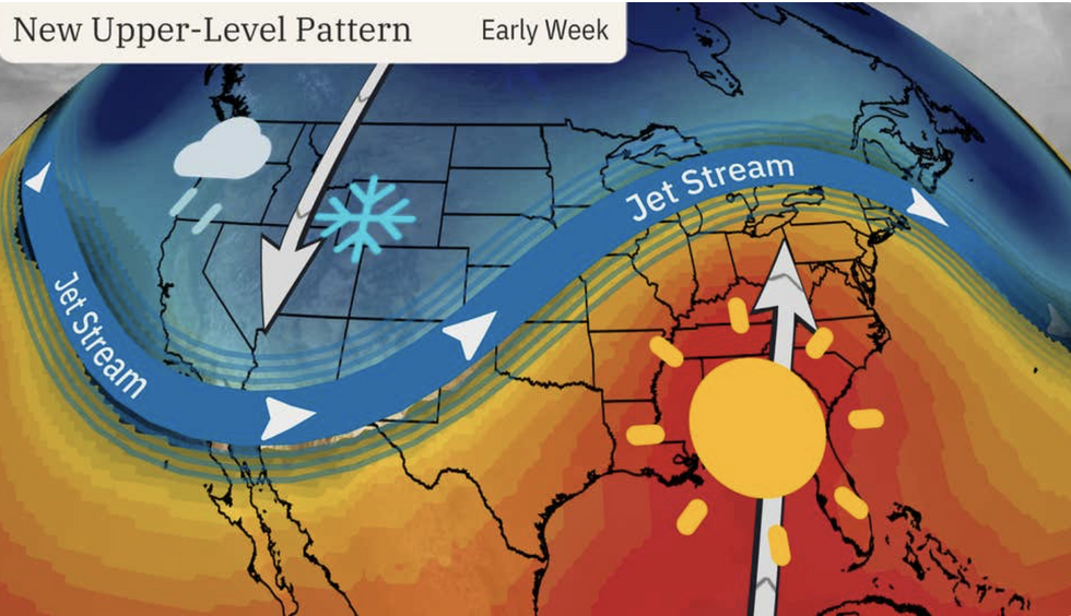
Warm weather to the east will, in part, be driven by a swerving jet stream as it rises northwards over the east
The Weather Channel
Further north, where rainfall has been in short supply, dry gusts will bring the threat of wildfires.
AccuWeather senior meteorologist Reynee Duff said: “Bouts of blustery weather, combined with record dryness, will keep the risk of wildfires elevated through the end of the month.
“Warm weather will return with a vengeance in the days leading up to Halloween.
“Record-challenging temperatures will first build across the middle of the nation early next week before expanding toward the East Coast by midweek.”
Thermometers by mid-week could smash the 80F mark putting the 1896 Halloween record under threat, she said.
However, parts of the country already bone-dry from summer could erupt into flames, she added.
She said: “Wildfire concerns will be amplified once again as conditions become breezier and the air temperature climbs higher toward the middle of next week.
“Dry brush, dead leaves and broken tree limbs can be a source of fuel for any spark.”
The west won’t see high temperatures
Weather.us
The US National Weather Service (NOAA) has wildfire alerts in force across Maine, New Hampshire, South Dakota, Wyoming and Nebraska.
A spokesman said: “There could be critical fire conditions on Monday with humidity and gusty southwest winds.
“A strong cold front on Monday night into Tuesday will bring rain east of the Laramie Range and snow to the west, but there is some uncertainty on the track of the low pressure, so snow amounts could change.
“Drier weather and warmer temperatures then return on Thursday and Friday.”
Warm weather to the east will, in part, be driven by a swerving jet stream as it rises northwards over the east.
A southerly plunge to its west side will steer colder air across Pacific States in an east-west split.
Weather Channel meteorologist Chris Dolce said: “The jet stream dropping southward into the West means temperatures will gradually turn colder than average across most of the region by Tuesday or Wednesday.
“Meanwhile, parts of the central and eastern states will see temperatures threatening record highs at times through midweek.”