Storm Ashley, the first named storm of the season, has hit the UK with hurricane-force winds of up to 80mph, prompting the Met Office to issue warnings across different parts of the country.
The entirety of Scotland and Northern Ireland are under a yellow warning for wind, with an amber warning in effect for northwest Scotland from 9am on Sudnay until midnight.
Met Office meteorologist Dan Stroud warned of “very strong, severe gales” coinciding with high spring tides could result in “very large waves”.
The storm poses a significant threat to public safety, with the Met Office stating that “injuries and danger to life is likely from large waves and beach material being thrown onto coastal roads, sea fronts and properties”.
The powerful storm formed as a low pressure system moved into a jet stream, undergoing rapid deepening in a process known as explosive cyclogenesis or a ‘weather bomb’.
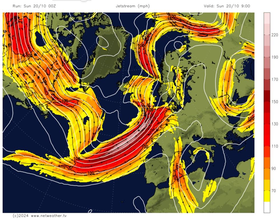
Storm Ashley low will move onto the polar side and into the left exit of the jet stream where it will undergo rapid deepening
Netweather
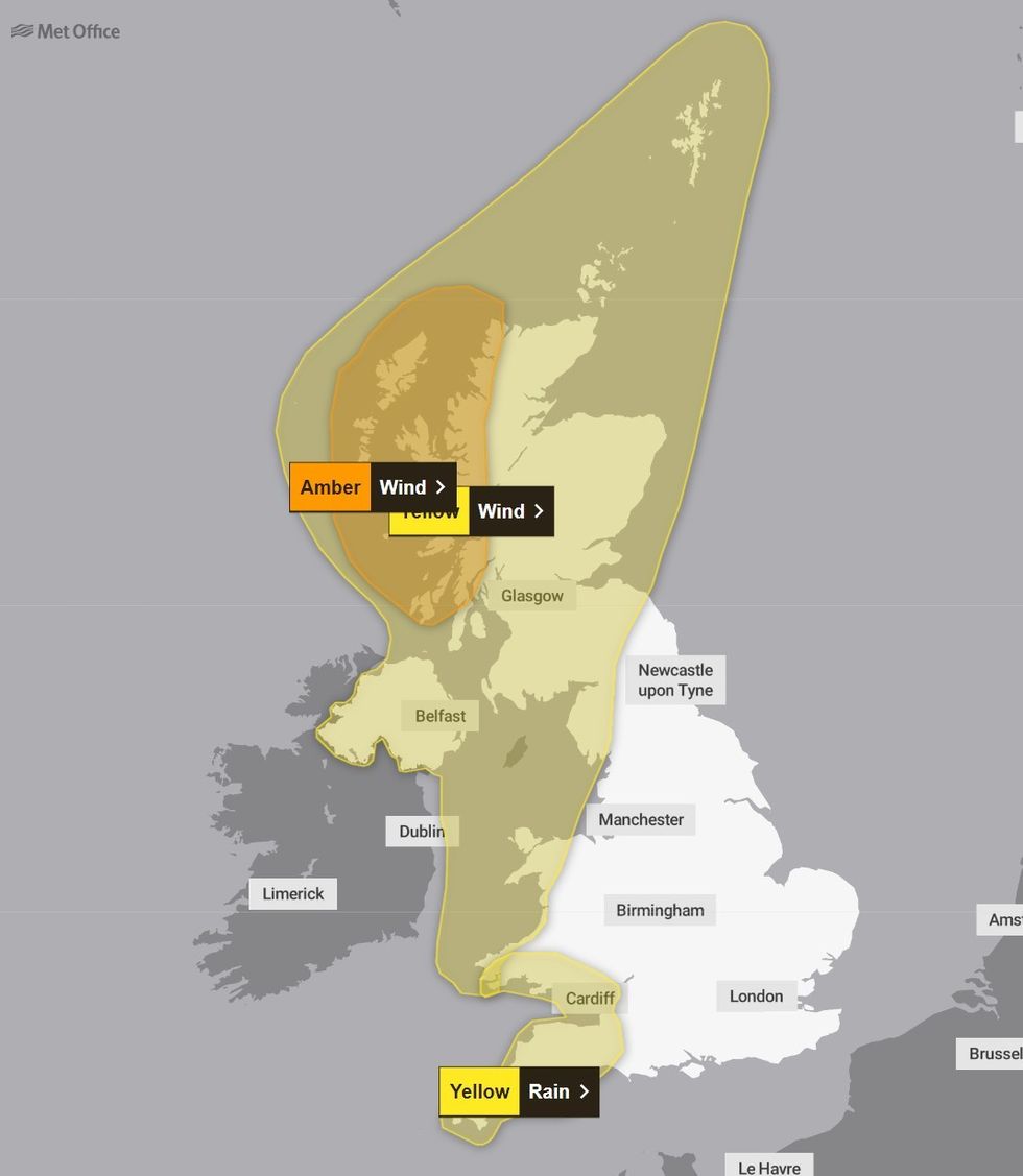
Met Office yellow and amber warnings are in place
Met Office
In a blog post about the storm, Netweather forecaster Nick Finnis, explained: “A fairly innocuous looking area of low pressure over the mid-North Atlantic this morning, to the north of the Azores, will undergo rapid deepening later today, as the low moves on to the polar side of a powerful 200 mph+ jet stream and into the developmental left exit region of the jet streak.
“This exit area of the jet stream is where very strong winds aloft fan out and cause divergence of the air aloft, creating a void which has to be filled by air rising up from below.
“This in turn causes air convergence at the surface and so lowers pressure at the surface, helping areas of low pressure deepen explosively.”
Meteorologists observed the storm’s central pressure drop by 44 hPa in less than 24 hours, far exceeding the criteria for a ‘weather bomb’.
UK LATEST:
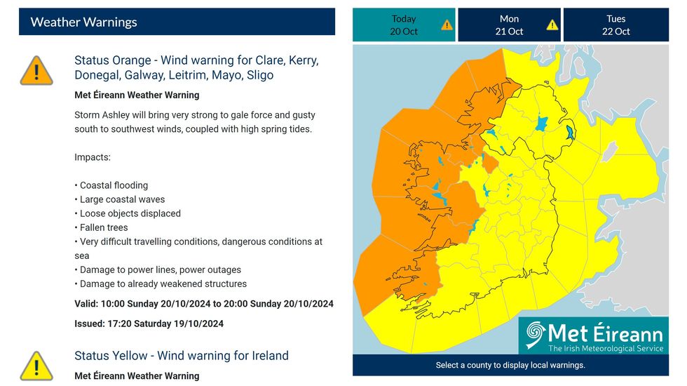
Met Eireann issued a weather warning for all of Ireland and Northern Ireland
Met Eireann
The storm reached its most intense phase west of Ireland, with a central pressure as low as 944 hPa although it has begun to weaken as it approaches the British Isles.
In Scotland, winds are expected to reach 70-80mph in western parts during Sunday afternoon with the north of Scotland remaining under a yellow warning for wind until 9am on Monday.
Northern Ireland faces similar conditions, with a yellow weather warning in place until midnight. The public has been advised to travel only if absolutely necessary.
In southwest England and South Wales, a yellow warning is in effect until midday on Sunday and residents have been warned that they may experience travel disruptions and potential power interruptions.
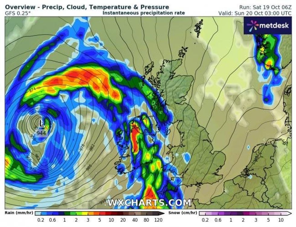
Storm Ashley: WXCharts map shows intense low pressure to west of UK
WXCharts
The Environment Agency has issued 41 flood warnings and 132 flood alerts across England, Natural Resources Wales reported three flood warnings and 13 flood alerts, and the Scottish Environment Protection Agency issued 16 flood warnings and 17 alerts.
Coastal areas are particularly at risk, with warnings for multiple areas of the River Severn, the south Cornwall coast, and the Wye Estuary.
Police Scotland has advised motorists to “plan ahead and avoid unnecessary travel where possible” due to the “strong likelihood” of disruption on roads.
Met Office meteorologist Ellie Glaisyer stated: “Parts of western Scotland could see gusts of 70-80mph during the afternoon.”
Gale force winds are expected to continue through Monday morning, potentially causing “fallen debris and trees” that could impact commuters at the start of the week.