Britain’s mild spell will give way to an ‘explosive’ weekend storm before temperatures rocket in another tropical blast.
Warnings for 80mph gusts are in force across Scotland and northern England as a powerful cyclone spins in from the Atlantic.
The storm will pull warm gusts back in from the south pushing temperatures after the weekend back into the 70Fs.
It will quickly strengthen on Saturday night with much of the country in for a turbulent end to the weekend.
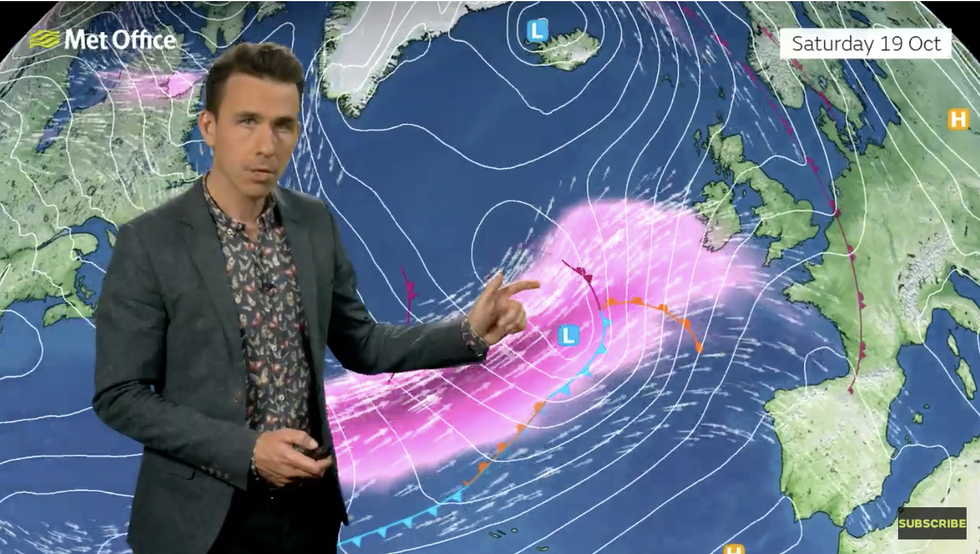 Jet stream strengthens the lowMet Office/Aidan McGivern
Met Office meteorologist Aidan McGivern said: “Late Saturday, a low-pressure system spins up virtually from nowhere, and it is a deep low.
“Winds are going to increase late Saturday and into the start of Sunday, especially western and north-western parts, and widely by the start of Sunday we can expect wind gusts in excess of 50mph, in some places 60mph, and in some of those exposed spots of the north-west, 70mph or 80mph.
“The most rapid deepening occurs out in the ocean and away from the UK, and the strongest winds stay out in the open ocean.”
The storm will strengthen ‘explosively’ as its pressure falls abruptly over the Atlantic, the Met Office added.
UK LATEST:
In the wake of the storm, warm winds from the south will push temperatures in parts back towards 20C.
After an Indian Summer ‘taster’ this week, the UK can expect a balmy passage into the last month of autumn.
Jim Dale, meteorologist for British Weather Services and social commentator, said: “Next week we are getting southerly winds again, and that is going to bring another spell of unusually mild weather.
“Last week was just a taster of the Indian Summer, and after the hors d’oeuvres, we expect the main course to arrive during the last week of the month.
“Southern regions will see the highest temperatures while northern and western regions take the sharp end of unsettled frontal systems coming in from the Atlantic.”
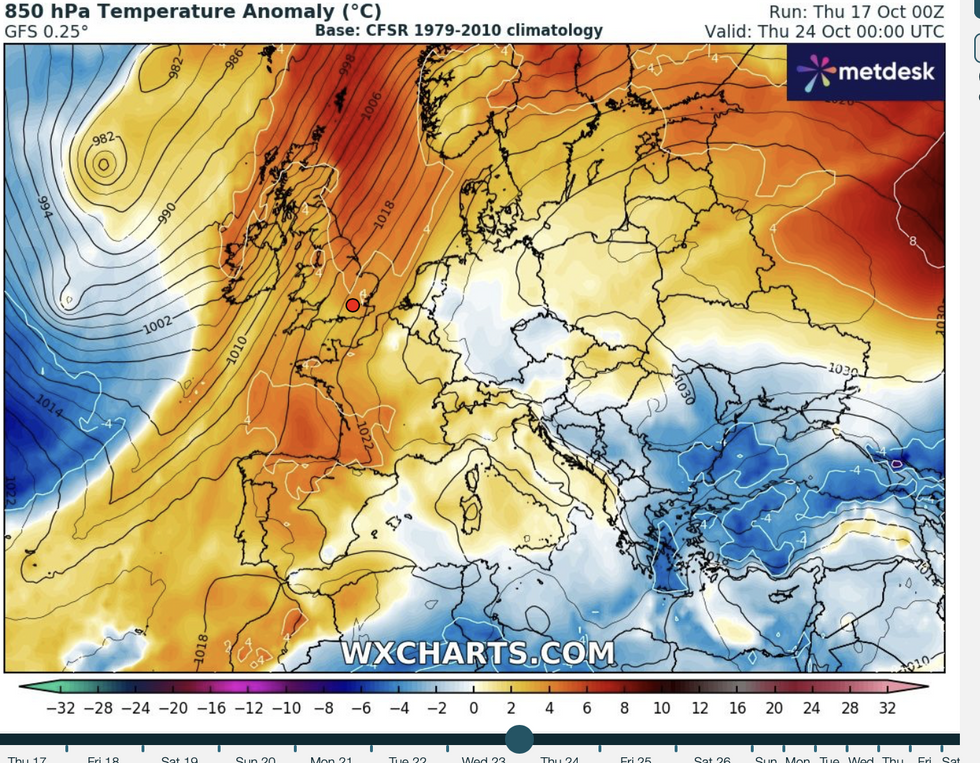
Southerly winds push temperatures back up
WX charts
Meanwhile, Britain is on storm alert with a major cyclonic low whipping up to smash the nation.
Winds will pick up on Saturday night as the system flips from the ‘warm’ side of the jet stream to the ‘cold’ side.
The jet, currently looping across the Atlantic, will straighten before it ploughs across Britain this weekend.
It will provide a conveyor belt to steer and power the weekend storm as it hurtles towards the UK.
McGivern said: “This low starts life near the Azores as a relatively shallow and flat feature, but during Saturday the jet stream picks it up.
“Initially the low is on the warm side of the jet stream but on Saturday it ends up on the cold side of the jet stream, and that is the area that these lows can spin up very rapidly, and it ends up as a very deep area of low pressure.
“It is north-western parts of the UK where we are likely to see the strongest winds, and the biggest impacts from this low.”
High tides will put coastal regions on alert for flooding as strong winds pull huge waves inland.
“That is why there is a yellow warning for wind across the north and north-west of the UK,” McGivern said.