A blast of Arctic air is set to sweep across the UK this week, bringing a sharp drop in temperatures and the potential for overnight frosts.
The cold snap follows a period of wet weather and thunderstorms that have battered parts of the country in recent days.
According to the Met Office, the chilly weather system will move southwards towards the UK on Tuesday, reaching Scotland and northern England by Wednesday.
Temperatures are expected to plummet, with some areas of Scotland potentially dropping to near freezing by Thursday morning.
The cold front marks a significant shift from the recent unsettled conditions, which saw heavy showers and thunderstorms affecting various regions, particularly in the southwest of England and Wales.
The temperature drop will be felt across the UK, with the Met Office forecasting particularly cold conditions in northern areas.
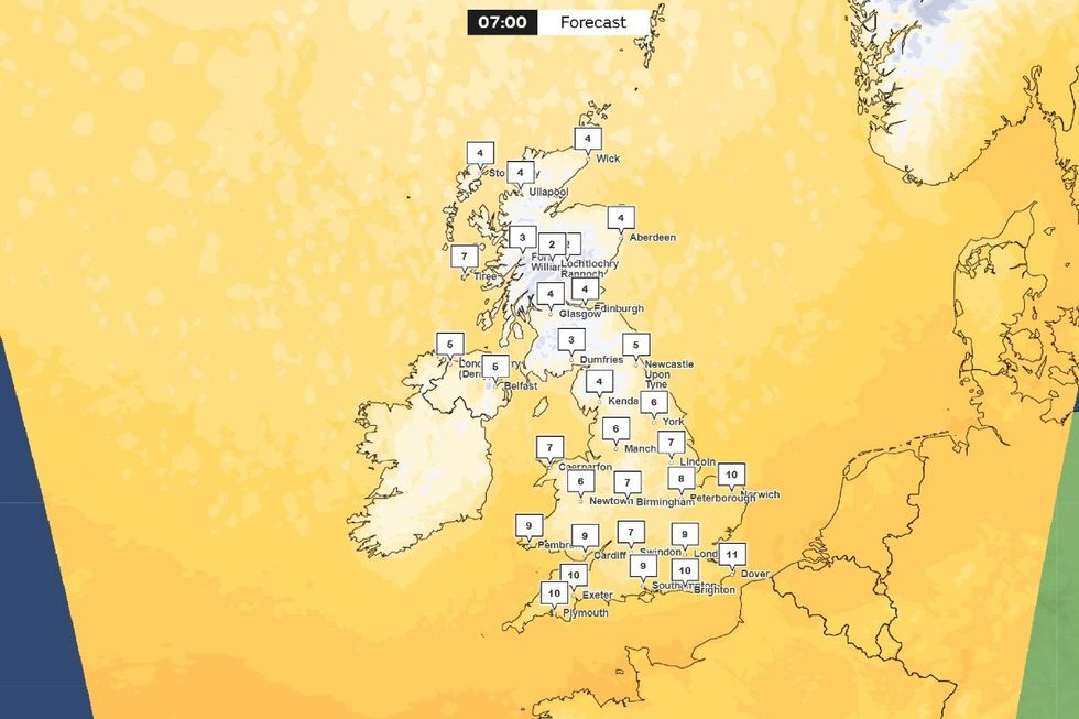
Met Office map: On Thursday morning, temperatures could drop as low as 2C
Met Office
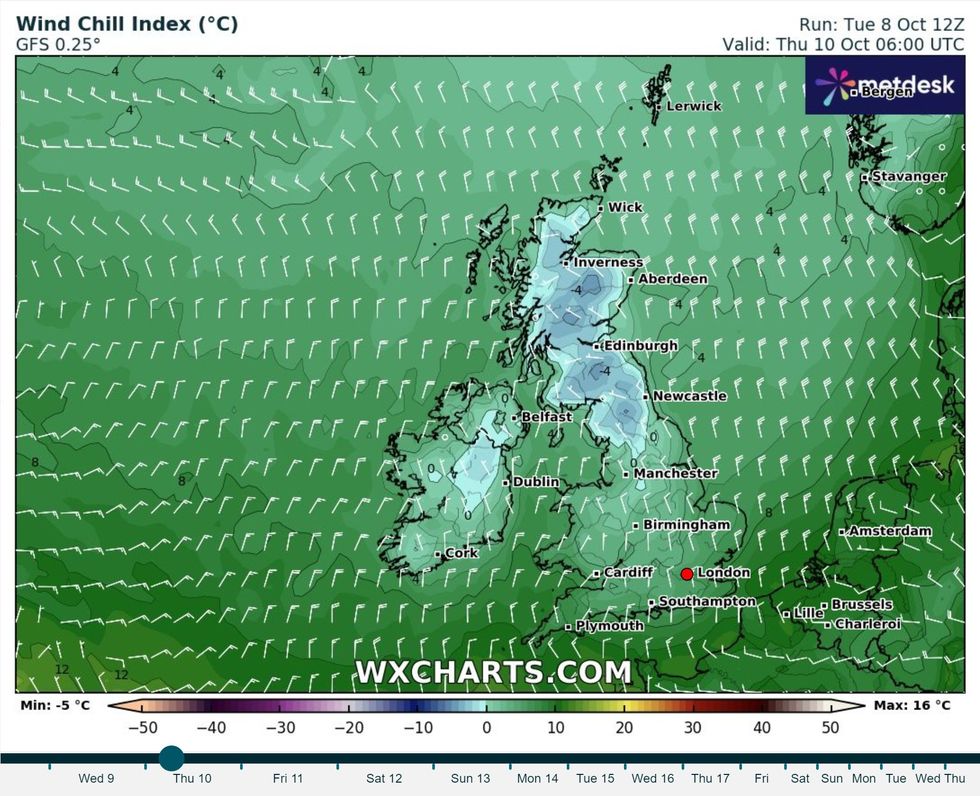
The Met Office is forecasting particularly cold conditions in northern areas
WX Charts
In North Yorkshire, temperatures could fall to as low as 2C on Thursday morning, while Burnley may see 3C.
Manchester and Leeds are expected to experience temperatures around 5C, with Liverpool slightly warmer at 6C.
Met Office meteorologist Alex Deakin explained the weather pattern: “There is an area of low pressure just generating the showers and pushing northwards.
“Also, there is this band of thick cloud sitting over northern England, Northern Ireland and southern Scotland for much of the day with outbreaks of rain.”
LATEST DEVELOPMENTS:
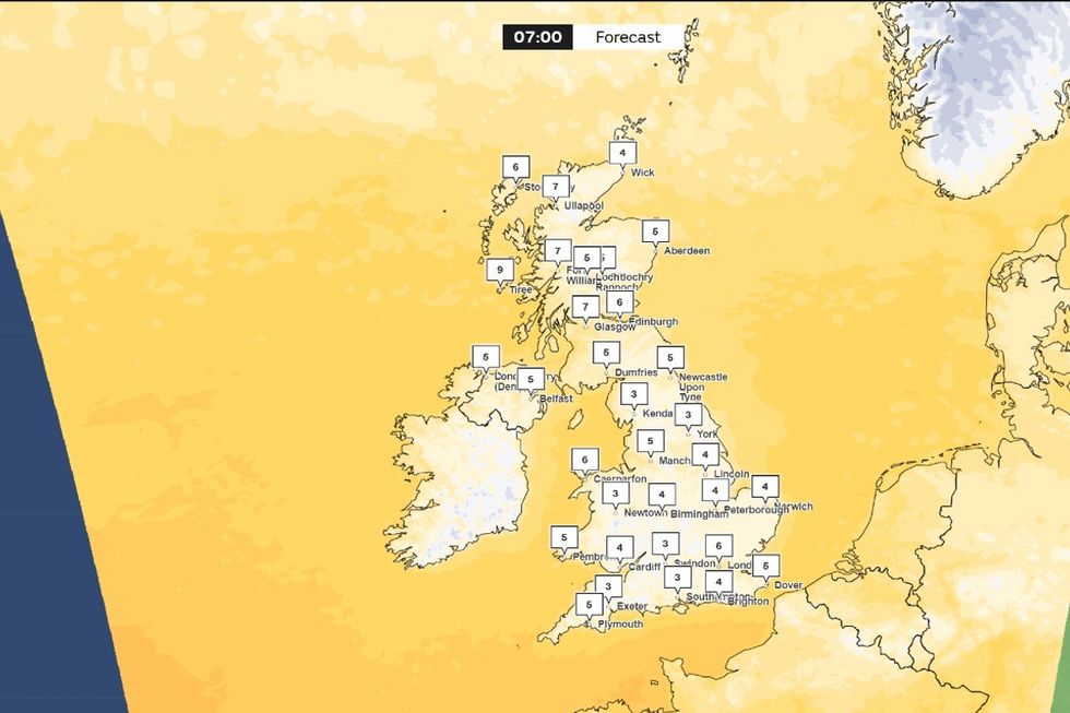
Met Office maps: 0700 forecast on Friday showing single-digits across Britain
Met Office
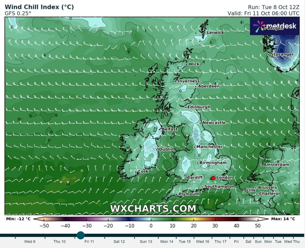
An Arctic wind chill will reach the south of Britain
WX Charts
The colder weather will be preceded by more rain on Tuesday and Wednesday, continuing the recent wet spell across much of the country.
The Met Office has warned of potential snow for the higher mountains of Scotland as the Arctic air moves in.
“Temperatures below average, especially in the north with some overnight frost possible along with some patchy mist and fog,” the Met Office stated.
The cold snap follows a period of uncertainty regarding the impact of ex-Hurricane Kirk.
However, the Met Office has confirmed that the system will not directly affect the UK, instead tracking south towards Portugal and Spain.
As the week progresses, the weather is expected to become drier and brighter, particularly on Friday and Saturday.
However, the colder temperatures will persist, with the possibility of rural frost overnight in some areas.
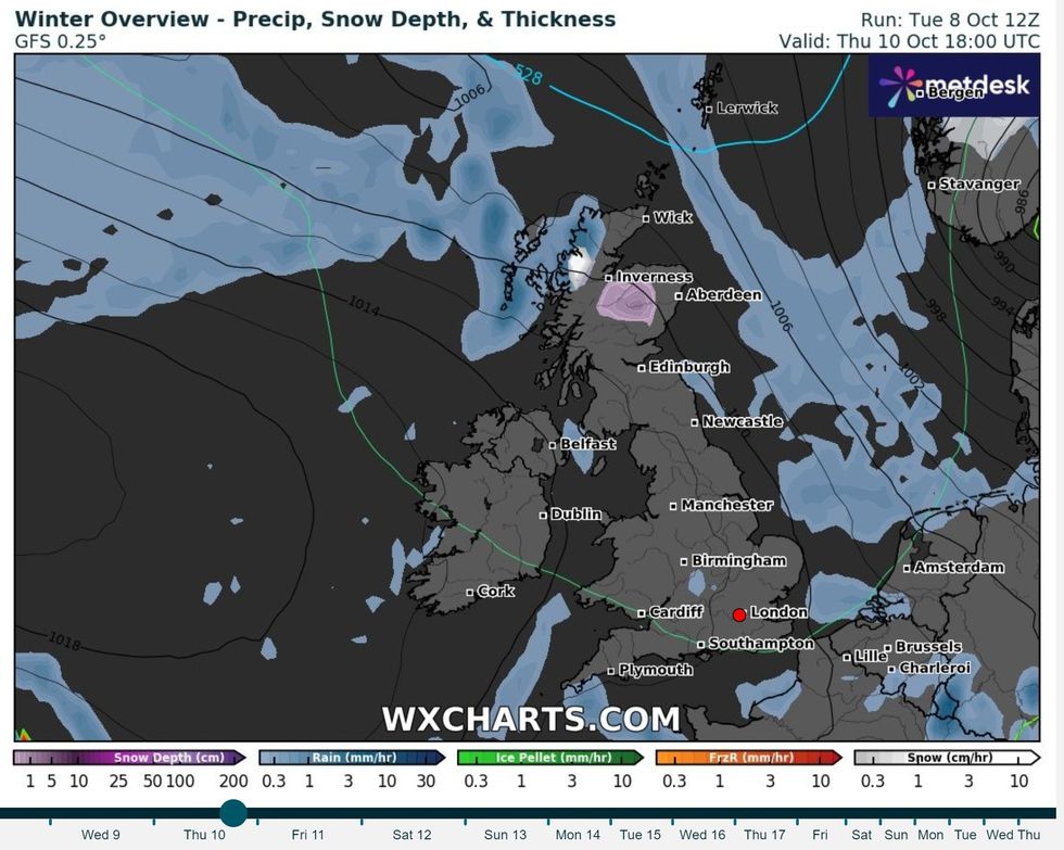
Met Office has warned of potential snow for the higher mountains of Scotland as the Arctic air moves in
WX Charts
Looking ahead, the Met Office’s long-range forecast for late October to early November suggests a continuation of unsettled weather.
Low-pressure systems from the Atlantic are likely to bring wet and windy conditions, particularly to England and Wales.
However, Scotland and Northern Ireland may experience longer dry spells. Towards the end of October, there’s a possibility of drier conditions, which could lead to overnight fog and frost in some areas.
Temperature-wise, the south may see average conditions, while the north and northwest are likely to remain below average.
The Met Office notes: “Later in the weekend likely to turn more unsettled once more with outbreaks of rain and some stronger winds expected to return to the northwest of the UK especially, although the southeast may well hang on to drier conditions throughout.”