Britain’s miserable start to autumn will take a mid-week breather before wind and rain return in the shadow of a tropical hurricane.
Ex-Hurricane Isaac, now a tropical storm, is heading towards the north Atlantic and may creep close enough to rattle the UK weather.
The knock-on effects of the post-hurricane could mean another bout of wind and rain ahead of the weekend.
While hurricanes do not directly affect the UK, energy and warm air left in their wake often disturb our weather patterns.
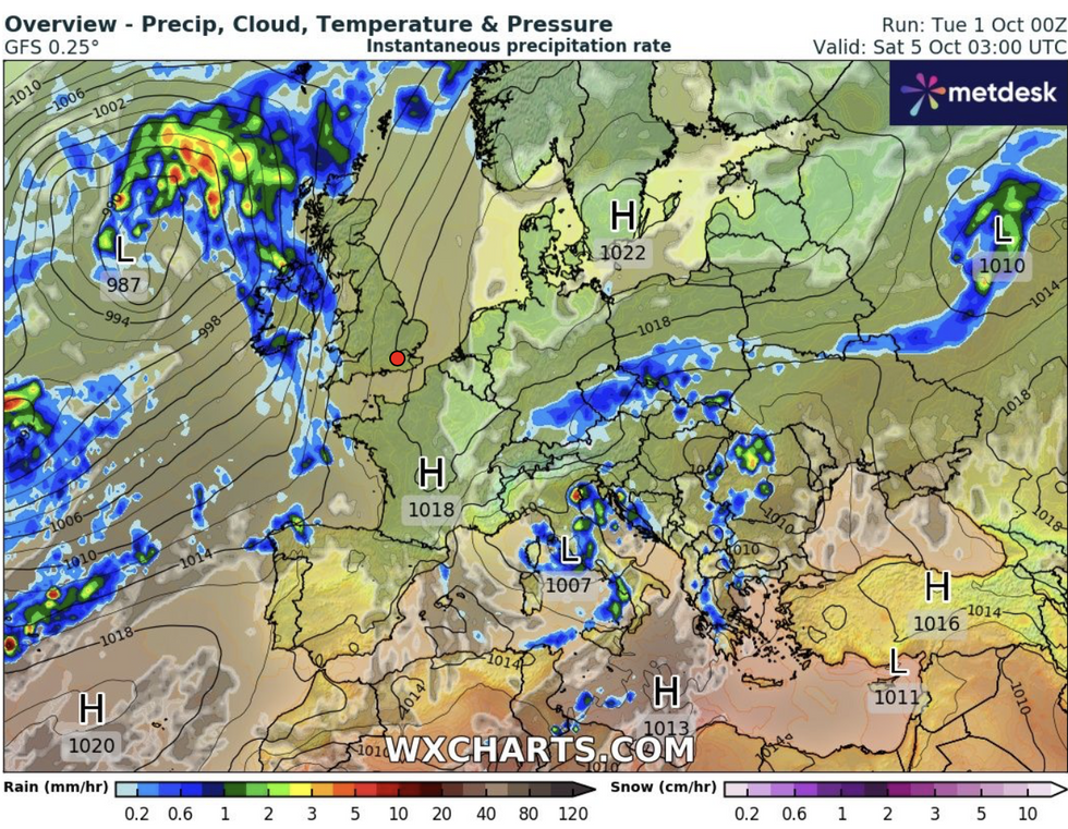
Wind and rain return powered by ex-hurricane Isaac
WX charts
Jim Dale, meteorologist for British Weather Services and social commentator, said: “Later this week there is an area of low pressure coming towards the northwest of the UK, and that could contain the remains of ex-Hurricane Isaac.
“While the weather is going to be reasonable during the middle of the week, ahead of the weekend the remains of Isaac could drive some wet and windy weather.
“It looks like we can expect more wind and rain after a relatively settled spell through the next couple of days.”
Energy associated with Issacs could nudge the jet stream helping it power separate Atlantic low-pressure systems.
Hurricanes are unable to survive the chilly waters of the North Atlantic, meaning the UK only ever experiences the effects of their remnants.
If these are swept on a southerly track, they can drive unsettled conditions across the UK, but if they veer further north, calmer and warmer weather is more usual.
Ex-hurricane Isaac is predicted to bring another spell of autumnal weather, which spells bad news to parts of the country already flooded.
LATEST DEVELOPMENTS:
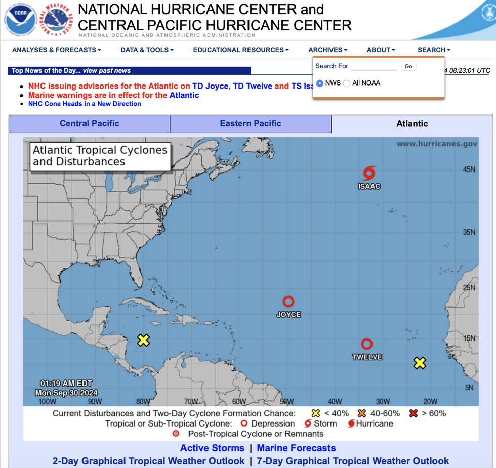
NOAA map shows hurricane and storm disturbances in Atlantic
NOAA
A Met Office spokesman said: “It should become somewhat drier and brighter more widely around midweek.
“However, there are signals for the potential of further wet and windy weather towards the end of the week.
“Hurricane Isaac is expected to transition into an ex-tropical storm while over the middle of the Atlantic, and if it does move towards the UK, it will have significantly weakened and would bring nothing more than a normal autumn spell of rain.”
It comes as the UK enters a particularly soggy start to autumn which brought more than twice the average rainfall to parts of the country.
Torrential deluges last week left swathes of central, southern and eastern England under feet of floodwater.
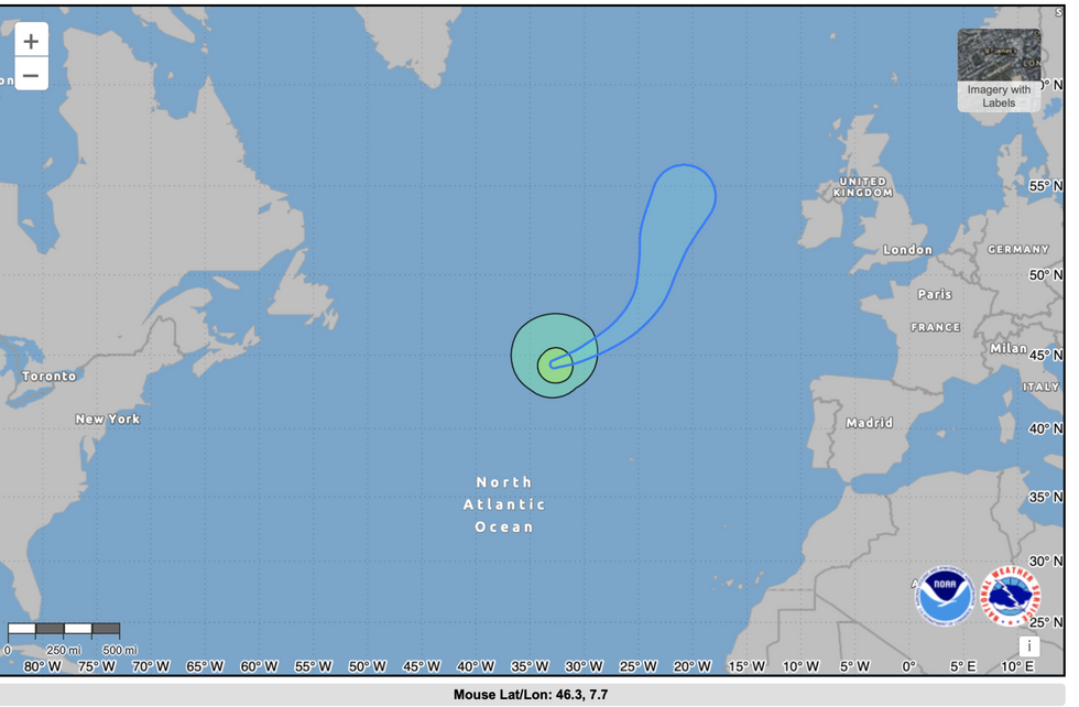
Predicted path of ex-hurricane Isaac
NOAA
The UK weather has entered an Atlantic-driven phase, allowing stormy low pressure to sweep in from the west.
High pressure, which brings drier conditions, will strengthen through the middle of the week, although lower temperatures will bring an early chill.
As winds return from the west during the weekend, temperatures could rise once again, with some outlooks predicting 20C, before the cold returns.
A Met Office spokesman said: “Areas of low pressure, initially centred over the Atlantic, will slowly meander eastwards across the UK through the weekend and into much of next week, albeit often on a track that is south-shifted relative to normal.
“This will bring more widely unsettled conditions, with periods of rain or showers, perhaps heavy and persistent at times, and perhaps accompanied by windy spells too.
“Later it may become more widely drier across northern areas, as colder conditions then become established more widely across the UK.”