Tropical storm Helene which formed in the Caribbean Sea is expected to strengthen into a major hurricane and move north towards the US, forecasters say.
Hurricane watches have been issued for parts of Cuba, Mexico and a stretch of the Florida coastline, including Tampa Bay, the US National Hurricane Centre said.
A tropical storm warning has been issued for parts of the Florida Keys.
The storm was located 170 miles (275 kilometres) southeast of the western tip of Cuba and had sustained winds of 45 mph (75 kph).
It was expected to strengthen into Hurricane Helene on Wednesday as it approached the Gulf Coast.
Florida governor Ron DeSantis declared a state of emergency in dozens of counties before the storm’s arrival.
Mr DeSantis is urging residents across a broad swathe of the state to prepare for potentially significant impacts, from the rural Panhandle region down the Gulf Coast to southwest Florida.
“We’re anticipating impacts, I mean, 100, 200 miles (161 to 322 kilometres) outside the eye of the storm, you could see with winds and you could see with surge,” Mr DeSantis said.
“We are going to see significant impacts no matter what happens.”
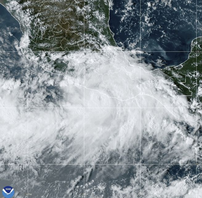
A National Oceanic and Atmospheric Administration satellite image shows Hurricane John near southern Mexico (NOAA/AP)
In a Tuesday morning update from the state’s emergency operations centre in Tallahassee, Mr DeSantis said it was telling that forecasters were already projecting the storm system may become a major hurricane — even before it was technically formed into a tropical storm.
Mr DeSantis said the storm is reminiscent of Hurricane Michael, a category five hurricane that rapidly intensified and caught many residents off guard before ploughing a path of destruction across the western Panhandle.
Communities that are still rebuilding from previous storms could get battered again, Mr DeSantis warned.
“The Big Bend and Panhandle should be especially prepared for direct impact,” he said.
Two people are dead after former hurricane John barrelled into Mexico’s southern Pacific coast, blowing tin roofs off houses, triggering mudslides and toppling scores of trees, officials said on Tuesday.
John grew into a major hurricane in a matter of hours on Monday and made landfall about 80 miles (130 kilometres) east of the resort of Acapulco before declining to a tropical storm after moving inland.
John came ashore near the town of Punta Maldonado late on Monday as a Category 3 hurricane with maximum sustained winds of 120 mph (190 kph).
It weakened back to tropical storm status early on Tuesday with maximum sustained wind speeds of 50 mph (85 kph) and was expected to weaken rapidly.
Evelyn Salgado, the governor of the coastal state of Guerrero, said two people died when the storm sent a mudslide crashing into their house on the remote mountain of Tlacoachistlahuaca, further from the coast.