A tropical plume will cleave the jet stream into fragments ushering warm gusts from Africa to finally unlock summer.
Temperatures next week are widely tipped to rocket into the high-20Cs or even the low-30Cs.
A U-turn in weather patterns will shunt low pressure to the north allowing southerly high pressure to build across the UK.
Britons will grit their teeth through just a couple more days of gloom before Sunday douses the nation in sunshine.
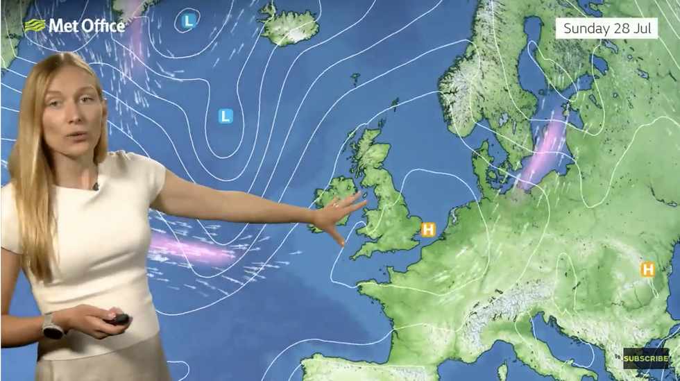
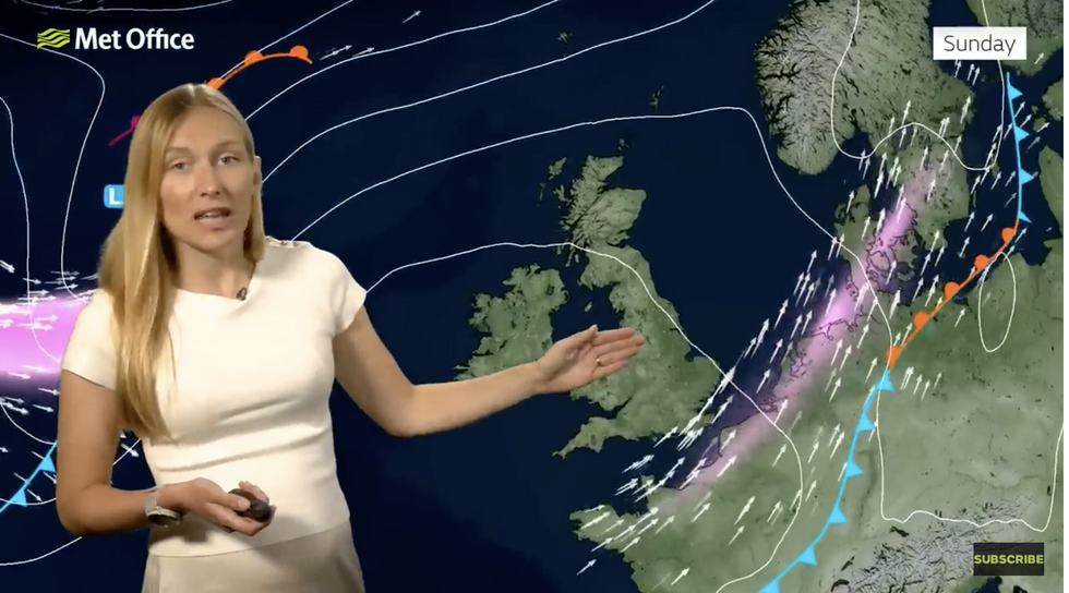 Annie Shuttleworth shows how weather patterns will change by SundayMet Office
Met Office meteorologist Annie Shuttleworth said: “As we head towards the weekend, the jet-stream shape slowly starts to change, buckling more and developing a trough to the west of the UK.
“It is possible we will see some showers through Saturday before it settles down on Sunday with high pressure becoming more dominant and the jet stream becomes a more split pattern.
“Sunday is going to be a very different day with high pressure dominating, with a bright start and plenty of sunshine through the day and temperatures climbing towards the mid-20Cs.”
Northern and western regions will be closer to low pressure and more at risk of rain and cloud.
High pressure will build over the Continent through the end of July pushing the warmth towards Britain.
South-eastern regions face the risk of tropical showers, although for most it is a picture of warm, sunny skies.
LATEST DEVELOPMENTS:
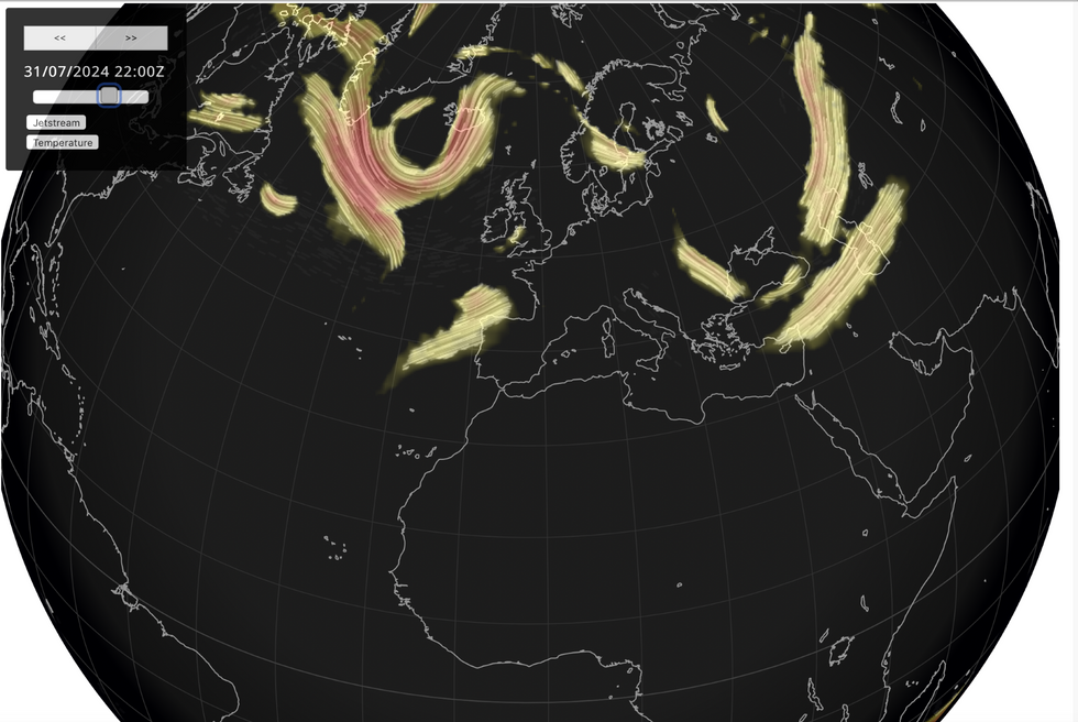
Jet stream splits and veers to the north
Netweather
Temperatures could hit the low-30Cs by mid-week, according to the Met Office, although it will be cooler in the north.
Shuttleworth said: “It looks like we could see a few warm days to start next week with temperatures in the high-20Cs and possibly the low-30Cs.
“It will be definitely sunnier than it has been recently and drier than the end of this week.”
But meteorological signals point to change again during the start of August as low pressure tries to barge back, she added.
The miserable summer so far comes after a Met Office report revealed last year was the second hottest on record.
The State of the UK Climate report also recorded the warmest June on record although overall, 2023 was the second wettest.
Last year beat several weather records consistent with the overall warming of the climate.
Professor Liz Bentley, chief executive of the Royal Meteorological Society which co-authored the study, said: “This report …helps to highlight the latest knowledge on our changing climate but also enables us to understand the trends, risks and impacts to help inform how we will need to adapt, now and in the future.
“The new analysis of days that are classified as ‘hot’ or having ‘exceptional rainfall’ highlights the increased frequency in high impact extremes we are already experiencing in the UK.”
With the Jet Stream divided high pressure will be allowed to build
Met Office
Next week could bring a taste of 2023, according to long-range forecasters who have promised Britons the long-awaited summer so far absent this year.
Exacta Weather’s James Madden said: “Major heat and potentially extreme temperatures are set to arrive on cue this weekend.
“From this Sunday to around Wednesday at the very least of next week, we will see a significant build of high pressure and a massive rise in temperatures.”
“Overall temperatures will skyrocket during this three-to four-day period, and there is no reason not to see top temperatures in the mid-30Cs in parts of the south.”
Jim Dale, meteorologist for British Weather Services and social commentator, added: “It will take only a little push to bring a change in the weather, and that is what we will see when high pressure begins to establish.”
Warming temperatures will be nudged by hot air pushing in from the Continent and the tropics.
Netweather meteorologist Jo Farrow said that next week could bring a “surge of heat from Africa”.