A European heatwave is set to send scorching summer temperatures to the UK with a chance of warm weather travelling from the Mediterranean.
Temperatures in and around London and the South East could hit 31C on Tuesday, according to the predictions, with the heat at its greatest at about 4pm.
However, the rest of the UK could be in for a treat too. Driffield, near York, in the north-east of England, is estimated to reach 25C and, even further north, in Middlesbrough a temperature of 24C is forecast.
Scotland too is looking set for a warmer spell on that day with a top temperature of 21C predicted for near Aberdeen.
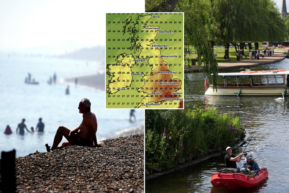
Temperatures are set to rise across the UK
PA/WXCharts
Saturday will be a day of sunny spells and showers. The showers will be heaviest in parts of Scotland, northern England, Wales and the Midlands, with the possibility of some isolated thunder.
There will be fewer showers in the south and southeast, although these areas may still experience some lighter showers during the afternoon. Temperatures will be close to average, but again feeling warm in the sunshine.
Deputy Chief Meteorologist at the Met Office David Hayter said: “As we go through the weekend, the jet stream will weaken to the west of the UK generating an area of high pressure that will slowly move in across the UK. High pressure means the air is sinking from higher in the atmosphere and that brings drier, settled and sunnier weather.
“Temperatures will rise too, becoming widely above average. We could see maxima of 27°C in the south and 25°C in the northeast by Sunday. There’s a bit more in the way of patchy cloud in Northern Ireland, south and west Scotland and the northern isles, so temperatures will be lower there.”
LATEST DEVELOPMENTS
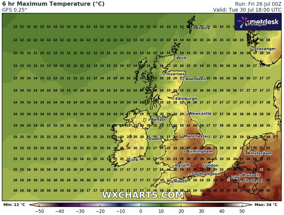
The latest forecast for Tuesday
WXCharts.com
Conditions look to turn increasingly warm, or even hot, in central, southern and eastern areas early next week and it is possible some places may reach heatwave criteria.
The Met Office says it is uncertain how long this warmer weather will last though, with a possible breakdown from mid-week.
The forecast for next week reads: “No single weather type is expected to dominate through this period. Some spells of dry, settled weather will likely alternate with wetter, cloudier conditions at times.
“The wettest conditions will probably be in the northwest, with the southeast tending to be driest. Through the period as a whole, warmer than average conditions are more probable, perhaps with some short-lived hot spells.”
According to the Met Office, a UK heatwave threshold is met when a location records a period of at least three consecutive days with daily maximum temperatures meeting or exceeding the heatwave temperature threshold.
In 2022, the UK saw the first red extreme heat warning to ever be issued in the country, causing it to be declared a national emergency on July 15.
Temperatures may have reached 40.3 °C at Coningsby, Lincolnshire on July 19, believed to be the first time the UK has exceeded 40 °C.